Rio Grande-Ute Basin Hike, Weminuche Wilderness, CO.
Free downloadable topo maps. Available for purchase.
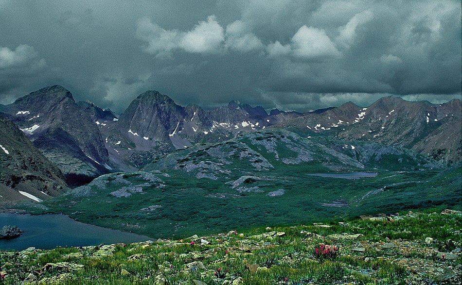
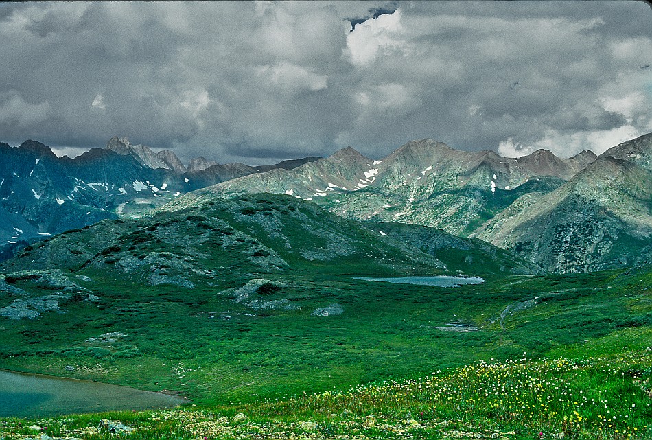
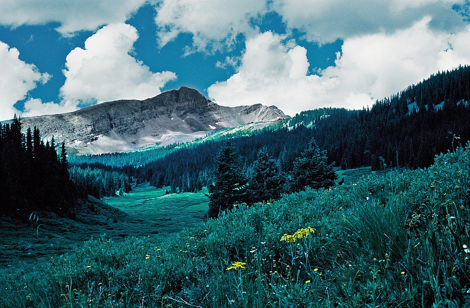
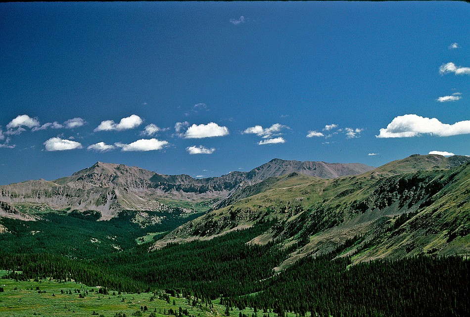
The Weminuche Wilderness (WEM-in-ooch), named for a sub-unit of the Ute tribe, occupies almost 500,000 acres in the San Juan mountains of southwest Colorado. It is high country with most of it above 10,000. There are 213 peaks of which 4 are 14ers and another 25 are over 13,500. Cutting through the very western section is the Durango-Silverton Railroad where stops at Needleton and Elk Pass afford hikers a unique trail shuttle opportunity. Traversing the wilderness are about 500 miles of trail including about 80 miles of the Continental Divide Trail and 20 miles of the Colorado Trail. Yeah, you can find some wilderness here.
The Map of the Wilderness: This map is FREE to download in a jpg format. The wilderness areas map is very large and cover thousands of acres so it is probably better for pre-hike planning than use on the trail. I have done several hike in the Weminuche and will be publishing several loop maps that will be easier to manage if you are downloding them. The trail maps will be available printed in color on 11x17, "Rite in the Rain” all weather writing paper for $5 per sheet plus S&H by emailing Charlie at cew5151@gmail.com. The maps are nominal 1:24,000 based on USGS 7.5 minute quadrangle topographic maps.Trip Mileage Table: Click hear to view or download trail mileage table (pdf) of the Rio Grande-Ute Basin Trip.
GPS Track: Right click this link and Save Link As to download the tracks in a gpx format. Save it to your computer and use your GPS software to load it to your GPS.
Google Earth Track: Right click this link and Save Link As to download the track in the Google Earth kml format. Save it to your computer, and open it in Google Earth and trace the route in interactive 3D.
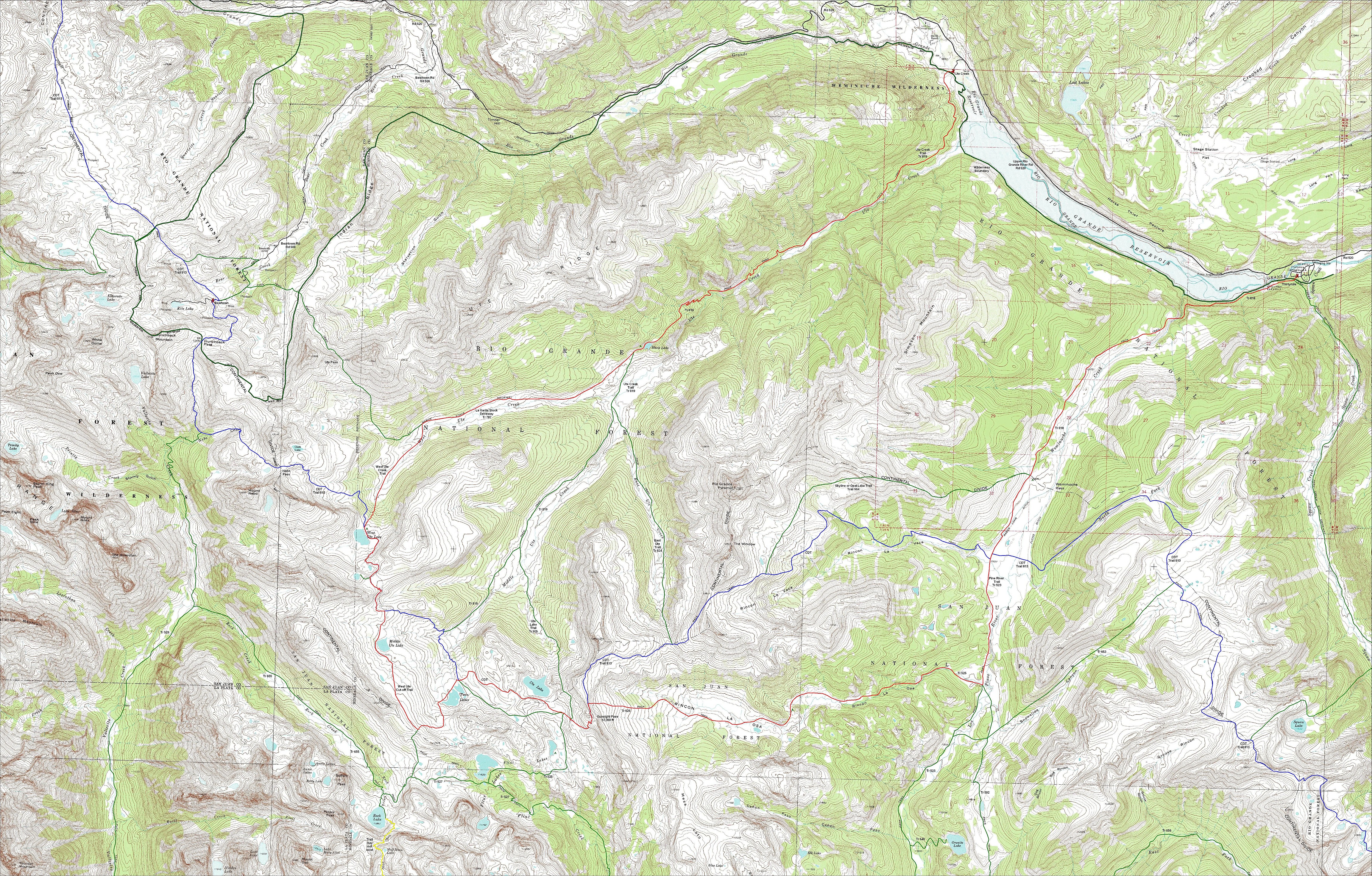
Rio Grande-Ute Basin Hike: This first hike is a 35 mile point to point horseshoe that begins at the east end of Rio Grande Reservoir and ends at the west end. You can also turn it into a full loop by walking 6 miles along the gravel road the follows the north side of the lake. The trailhead is in the southwest portion of Thirtymile Campground at the east end of Rio Grande Reservoir. There is a trail junction as soon as you begin your hike. The left fork heads south on Squaw Creek Trail #814. Instead, take the right fork and follow the Weminuche Creek Trail (#818) west paralleling the lake. The first 1.2 miles is fairly level through conifer forest above the lake. The next 0.8 miles is a climb of about 800 feet though a wooded canyon. At about 2 miles, the trail open up into the broad meadowed valley of Weminuche Creek. Cross a stream draining from Simpson Mountain at 3.75 miles and reach Weminuche Pass at 5.1 miles.
Weminuche Pass is on the Continental Divide. To the south is the Pinos Creek drainage and the official designation of the trail becomes the Pine River Trail, #523.
At the pass, trail #564 (named the Skyline Trail on a Forest Service map and Opal Lake Trail on the Trails Illustrated map) comes down the Continental Divide from the west. In 1.2 miles (mile 6.3 on this trip), the Continental Divide Trail (CDT, #813) comes in from Rincon La Vaca (rincon is Spanish for corner but also means an isolated place. It is locally used to mean a small remote valley. La vaca is Spanish for cow). You may run across other references that identify the Skyline/Opal Lake trails as the CDT and call the trail in the Rincon La Vaca, the Rincon La Vaca Trail (examples: the narrative from the Forest Service document that describes the CDT in this area and an old trail guide by Dennis Gebhardtm A Backpacking Guide to the Weminuche Wilderness, 1987). The Backpacker Colorado 16 team followed the Rincon La Vaca route.
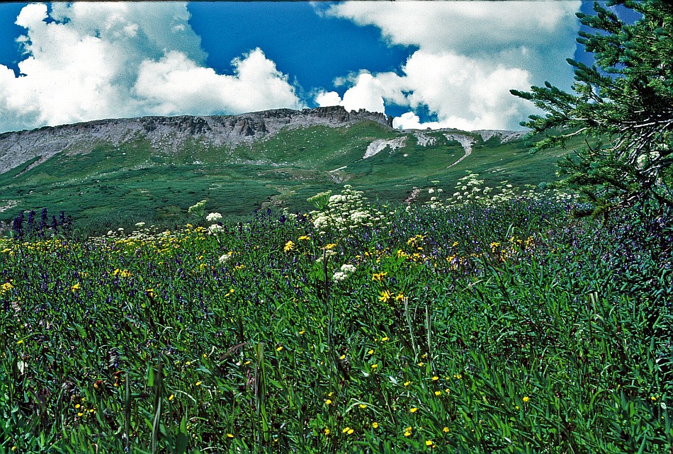
Following the Pine River Trail for another 1.8 miles (mile 8.1) brings you to another trail coming in from the valley from the west. This is the Rincon La Osa Trail (la osa means bear). Follow it for 6 miles to intersect the CDT at Gunsight Pass. The Rincon La Osa valley begins with a meadow but becomes wooded within 0.3 miles. It climbs through the forest for about 1.7 miles and finally enters a rocky meadow at about trip mile 10. Except for a couple timbered knolls about a mile up the trail, the rest of the trip to Gunsight is in riparian and alpine meadows. We were there in late July and the upper meadow on the approach to Gunsight was a riot of wild flowers. Just as you reach the top of the climb, the CDT will come in from the north. Turn left with the CDT and follow it to the pass.
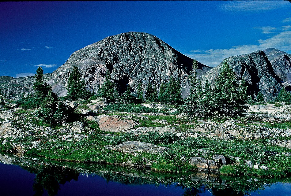
Gunsight Pass (14.1 miles) is not named on the USGS or Trails Illustrated map. Gebhardt uses the term in his Weminuche backpacking guide and puts the pass at 12,360 feet. Regardless of the name, the narrow ridge of friable rock affords a 360 degree view of where you came from, the Rio Grande Pyramid and where you are going.
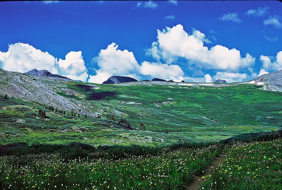
Stay on the CDT and descend to the Ute Basin. The basin is all above the treeline, with most of it above 12,000. It is covered with alpine grass, low shrubs and bare rock. Just before reaching Ute Lake, the Flint Lake Trail (#525) comes in from the south. We took it about a half mile to the first Flint Lake and set up camp (this one mile round trip excursion is included in the total trip mileage). There are great views of the unnamed peaks south of the Flint Creek valley. Back on the CDT, cross above Ute Lake at about 12,000 feet (mile 16.7).
At 17.9 miles is Twin Lakes and the junction of the Rock Lake Trail. We left the CDT trail and headed south across the meadows and up towards the Continental Dividee to get a peek of the Rock Creek drainage and the surrounding moonscape. From the divide, we backtracked a few hundred feet to the West Ute Cut-off (mile 19.1), went north to Middle Ute Lake (mile 20.5) and further to the intersection of the CDT (mile 20.9). Up and over a small divide separating Middle and West Ute Lake basins and in 1.7 miles we were at West Ute Lake (mile 22.6).
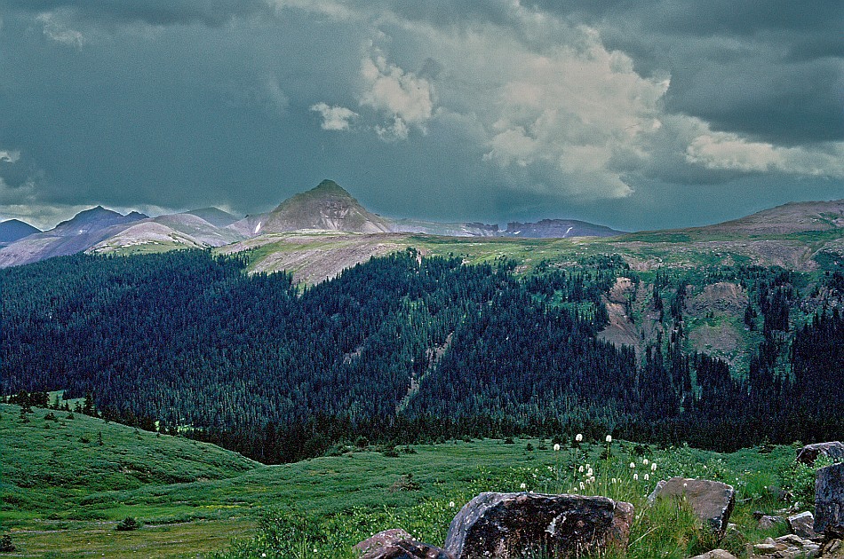
There is a camping ban within 200 feet of the lake. Although the lake basin is treeless, we were able to find a nice campsite in the trees just to the north which would be well beyond the forbidden zone. With two nights at West Ute, we had plenty of time to explore. By following the CDT to Nebo Pass and beyond, you can get some terrific views across the Vallecito Creek drainage of the Guardian, Silex, Storm King, Peak One, White Dome, Hunchback and slew of other peaks.
The West Ute Trail branches off the CDT a few hundred feet north of the lake. A 600 foot descent over 1.6 miles brings you to West Ute Creek and the intersection of the La Garita Stockway (#787, mile 24.2). Though it sounds like a busy place, and probably was when cattle grazed these open valleys, it is just a trail. You will stay along the north side of the meadow at the edge of the trees for the next 3.1 miles. Just before entering the woods and reaching Black Lake, the Ute Creek Trail (#819) takes off to the south, dropping 200 feet into the Ute Creek Valley and, in about 0.8 miles, splitting into the East Ute Trail (#824) and Ute Creek Trail (#819).
When we got to Black Lake (mile 27.4), the sky tore open and it rained as hard as I have ever seen in the backcountry. Taking shelter in the trees, we waited out the storm and found a place to camp. The camp site was fine but Black Lake is not very attractive. The water didn’t look appetizing so we took the long hike down to the creek for water.
The remaining 7.4 miles is mostly through the woods. The trail drops another 1,400 feet and finally brings you out at the Rio Grande and the Ute Creek Trailhead (mile 34.8). There is no bridge across the river, so be prepared for a ford.
To Buy Maps: The trail maps are coming soon. They will be color, 11x17 maps on weatherproof paper are available for $5 each ($10 for the set) plus S&H by emailing Charlie at cew5151@gmail.com (copy and paste in your email).
----Photos by Peter Val Kranak----