Seven Devils Loop, Idaho

Free downloadable topo maps of the Loop. Available for purchase.

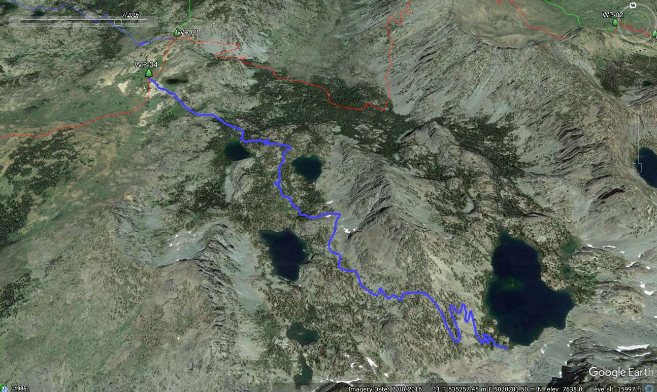
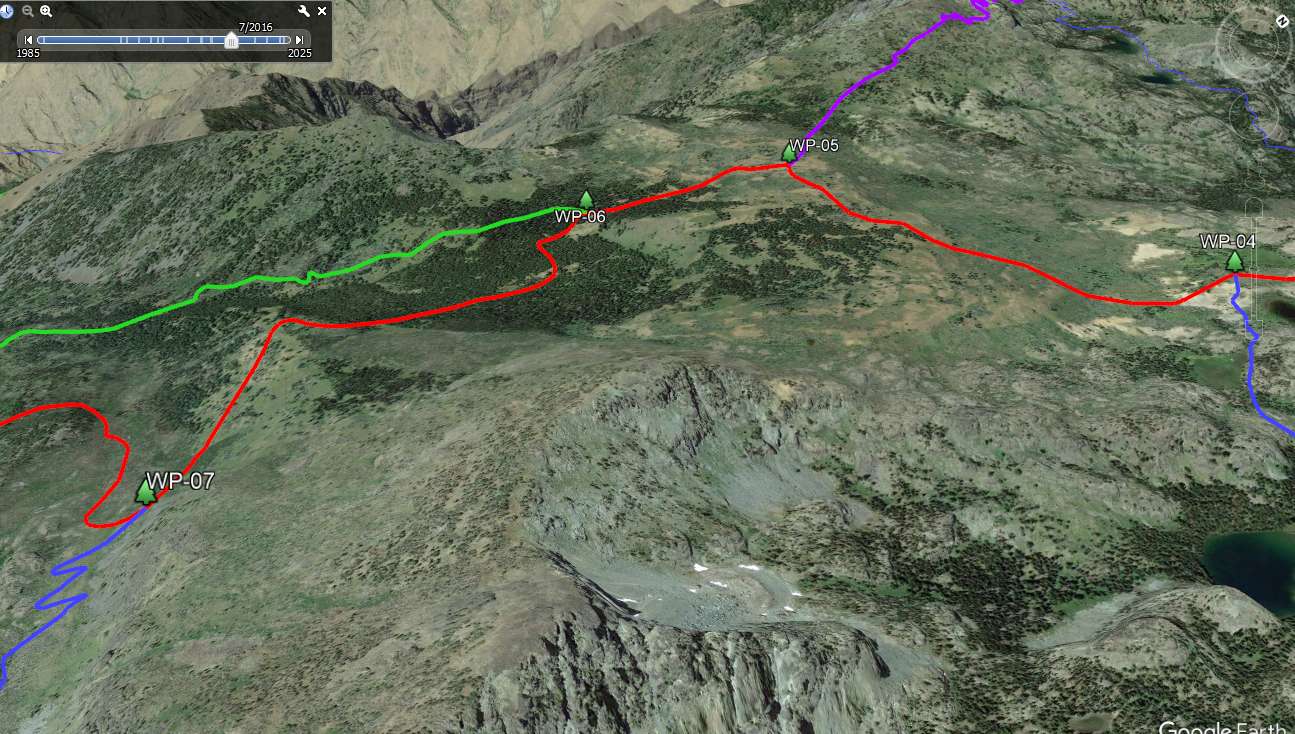
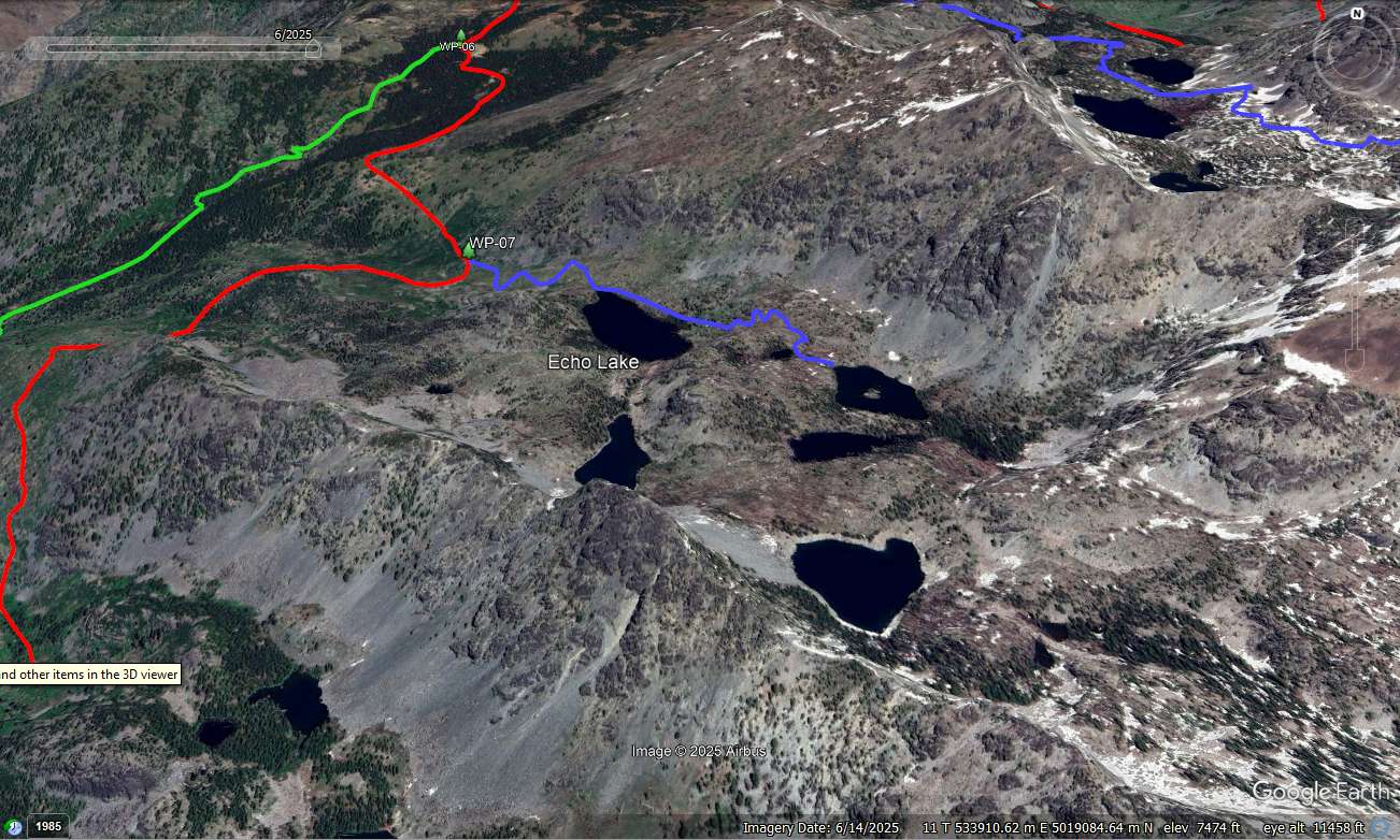
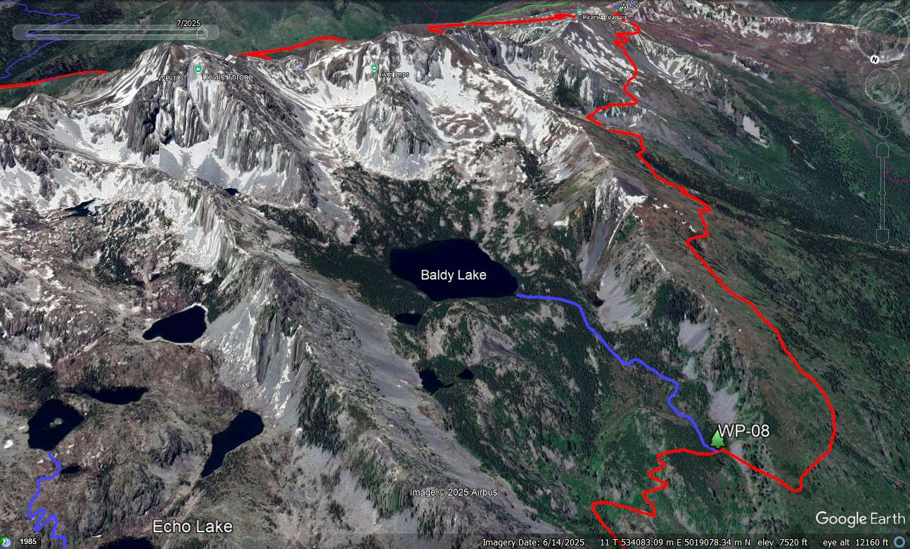
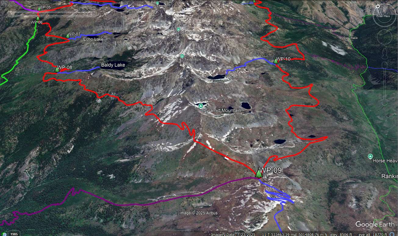
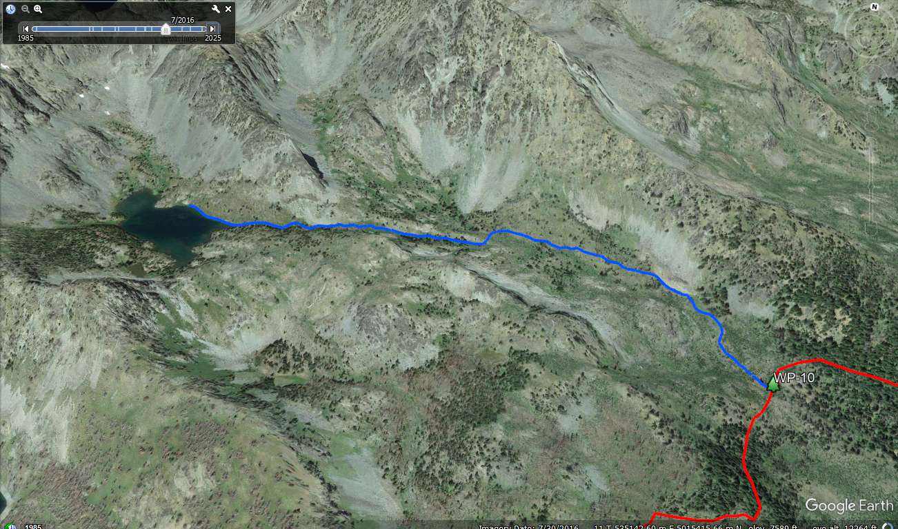
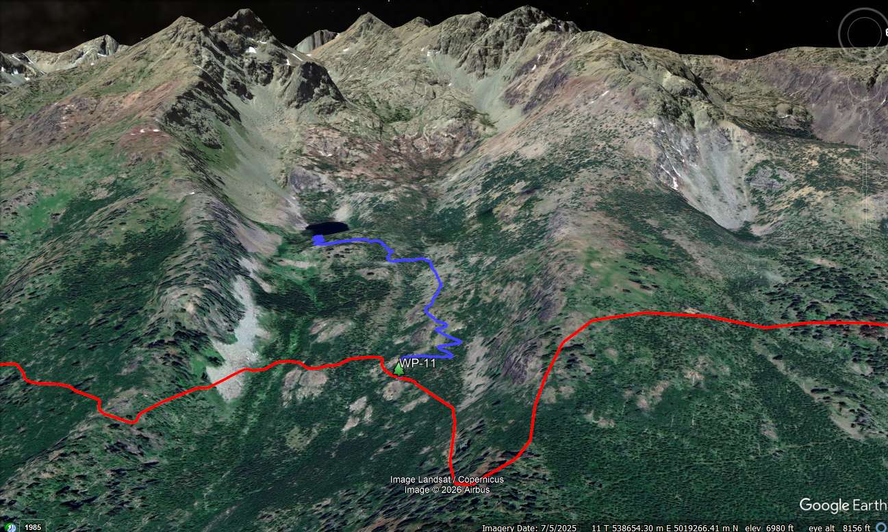
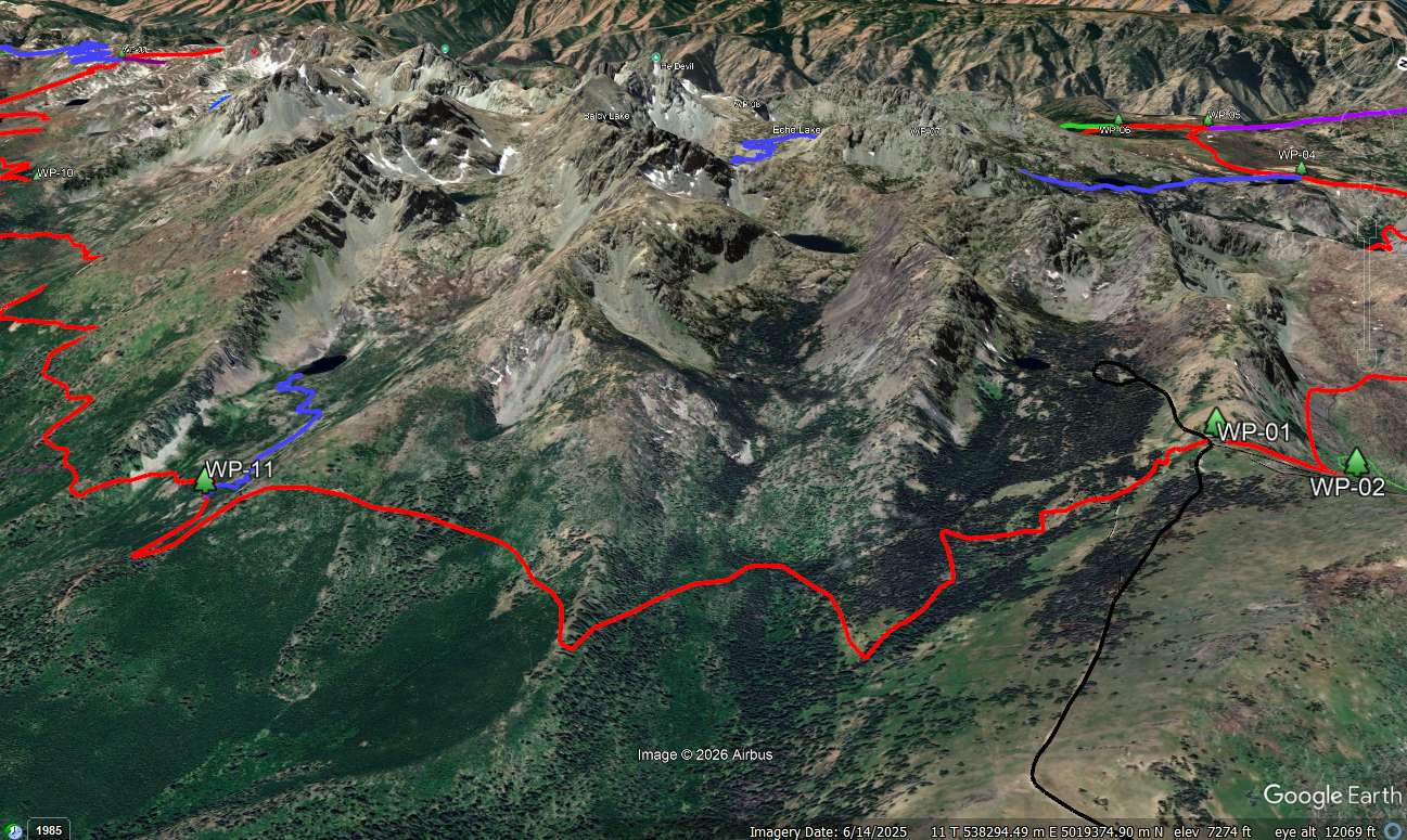
Overview: From the highest point on He Devil Mountain (9,393 feet) to river level of the Snake River in Hells Canyon is an 8,043 foot drop, making this the deepest river gorge in North America. The Seven Devils Loop is a 26.7 mile trail around the Seven Devils Mountains in west central Idaho that overlook the river. The Loop itself rings the range but never penetrates it making a good backpacking trip a much longer hike than 27 miles. You will want to cutomized your hike to match your days by taking any or many of the spur trails into the heart of the range to visit the alpine lakes and ancient cirques.

GPS File: Right click this link and Save Link As to download the tracks in a gpx format. Save it to your computer and use your GPS software to load it to your GPS.

Google Earth Track: This link is to a Google Earth KML file for all the tracks on the big map. You should be able to right click the file and save it on your computer. Then open it with Google Earth to see the entire wilderness trail system in interactive 3-D. Once in Google Earth you can access individual tracks.

The Area Map: This map is FREE to download. The maps of the hike will be available printed in color on 11x17, "Rite in the Rain” all weather writing paper for $5 plus S&H by emailing Charlie at cew5151@gmail.com. If they aren't there yet, email me and I'll make them for you. The maps are nominal 1:24,000 based on USGS 7.5 minute quadrangle topographic maps.

.

Want to do some trip planning? A larger area map is provided that encompasses the entire loop and some of the surrounding area. It is 10 mb so it may be slow to download. A preprinted version of this map is NOT available.

Seven Devils Map at 1:24,000 scale.

The Google Earth (GE) image to the right (click for full size) is northeast-facing and shows the relationship between Hells Canyon on the left and the Seven Devils Range. Note the Snake River National Scenic Trail along the river (blue), the Loop trail (red), spur trails to the interior lakes (blue) and several trails connecting the Loop and the river. The latter typically have a relief change of about 4,000 to 6,000 feet with few opportunities for camping to break up a long assent.

Seven Devils GE Overview.

WP-01 (N45.34946, W116.51209): The Windy Saddle Trailhead sits in the saddle formed by the ridge to Heavens Gate (north) and the north side of the cirque that holds Seven Devils Lake and campground. It is accessed from Idaho Highway 95 via the Seven Devils Road (FR 517). This narrative will follow the trail counterclockwise.

Leave the trailhead parking lot and head north on the Seven Devils Trail (#124, red), descending 400 feet into East Fork Sheep Creek. Intersect Sheep Creek Trail (#53, green) at 0.4 miles (WP-02). Trail #53 goes north and intersects the Bernard Creek Trail #58 in 5.3 miles, which in turn will take you to the river (see more information under WP-03).

Sawtooth Area Map at 1:24,000 scale.

WP-02 to WP-04: This section is 5 miles and involves 2 ridge accents. Keep left at the junction (WP-02) and contour around the head of East Fork Sheep Creek valley. Ascend 800 feet up a ridge. From the ridge descend 1300 feet into the West Fork Sheep Creek Valley and then ascend 600 feet to WP-03. WP-03 sits at the junction of Dry Diggins Ridge Trail (#140, green) on top of Dry Diggins Ridge (duh). The trail #140 goes north for 3.7 miles to where it intersects the Bernard Creek Trail (#58, purple) which can be taken west and down 4,000 feet to the river or east to intersect with the Sheep Creek Trail.

A few hundred feet further down the Loop trail, the Bernard Lakes Trail (#57, blue) splits off to the north west. This 2.7 mile trail passes Bernard Lakes and ends at the Dry Diggins Lookout Trail (#56, purple). Stay on the Loop for 0.4 miles to WP-04.

Seven Devils GE WP-02 to WP-04.

Sheep Lake Trail: WP-04 is the intersection of Sheep Lake Trail (#123, blue). The spur trail is a little over 3 miles ling and ends at Sheep Lake. This is your first opportunity to penetrate the Seven Devils and see some of the lakes including Basin, Shelf, Gem and of course Sheep. We camped at Basin Lake and dayhiked to Sheep.

Seven Devils GE Sheep Lake.

WP-05 to WP 07: Back to WP-04 to pick up the Loop trail and turn left. WP-005 is 0.9 miles and over fairly level ground. It is the junction with the Dry Diggins Lookout Trail (#56). Dry Diggins forms a horseshoe with the Bernard Lakes trail that can bring you back to WP-03. It is about 0.3 miles further to WP-06, tand the Little Granite Creek Trail (#112). Little Granite will take you to the river in 6 miles and a 6,000 ft descent. Another 1.1 miles and you will arrive at WP-07.

Seven Devils GE WP-05 to WP-07.

Echo Lake Trail: WP-07 is the junction with the Echo Lake Trail (#129). It will take you to Echo Lake in 0.6 miles and He Devil Lake in 1.6 miles. Quad and Triangle Lakes also share thie basin but are off trail...which can be good thing.

Seven Devils GE Echo Lake.

WP-08 and Baldy: From WP-07, it is 1.8 miles to WP-08 and the Baldy Lake Trail (#129). The Baldy Basin sits below Devils Throne and Twin Imps peaks. Baldy Lake is about a mile from WP-08, with a 400 foot up hill. As with the other basins, Baldy Lake Basin provides ample opportunity to explore. Open the KML file and zoom in. Looks pretty incredible.

Seven Devils GE WP-08 and Baldy Basin.

WP-08 to WP10: The trip from WP-08 to WP-09 is 4.5 miles and takes you past the lower cirque of Devils Farm and along the side of Pyramid Mountain. WP-09 is the terminous of the Seven Devils Trail and junction with 3 others. 1) Going west is the Devils Farm Trail (#114, purple) which drops 6,000 in 9 miles towards the Snake River. It is another mile on the Little Granite Creek Trail to the river. 2) Going south is the trail (blue) to Horse Heaven, the Carbonate Hill prospects and Stevens Saddle. These trails offer a couple options to extend your hike and also pick up the view from Horse Heaven. 3) Going east is the South Boise Trail (#101, red) which is the designation for the Loop on the east side of the range. We are taking the Boise Trail (#101, red) 4.1 miles to WP-10 and the junction of the Dog Lake Trail (blue).

Seven Devils GE WP-08 to WP-10.jpg.

Dog Lake Trail:Though the Forest Service does not designate or maintain a trail to Dog Lakes, we had no trouble finding the one shown on the map and reaching the lake. That said, looking at the 2016 path on Google Earth, 1) the path was difficult to see in a few sections and 2) there was a lot of blow down. If you can't make it, there is a small outlet stream the passes the Loop Trail.

Seven Devils GE Dog Lake.

WP-11 and Cannon Lake: Leaving WP-10, it is 4.2 miles to WP-11 and the Cannon Lake Trail (#126, blue). You will pass Hanson Creek so if things turn sour at Dog Creek, you should find water here. The Cannon Lake Trail is 1.0 and climbs 300 feet. Nestled in its glacially carved valley, it has some goog views of the surrounding cliffs.

Seven Devils GE WP-11.

WP-11 to WP-01: The remainers of the hike back to WP-01 stays on the east flank of the range, as it has since turing the corner ar WP-09. The Loop finishes on the Boise Trail with a 3.5 mile hike back to the Windy Saddle Trailhead. The first part of the trail is fairly level. The last part is your final treat, an 800 accent over the last mile.

Happy hiking!

Seven Devils GE WP-11 to WP-01.

To Buy Maps: The trail maps are coming soon. They will be color, 11x17 maps on weatherproof paper are available for $5 each ($10 for the set) plus S&H by emailing Charlie at cew5151@gmail.com (copy and paste in your email).