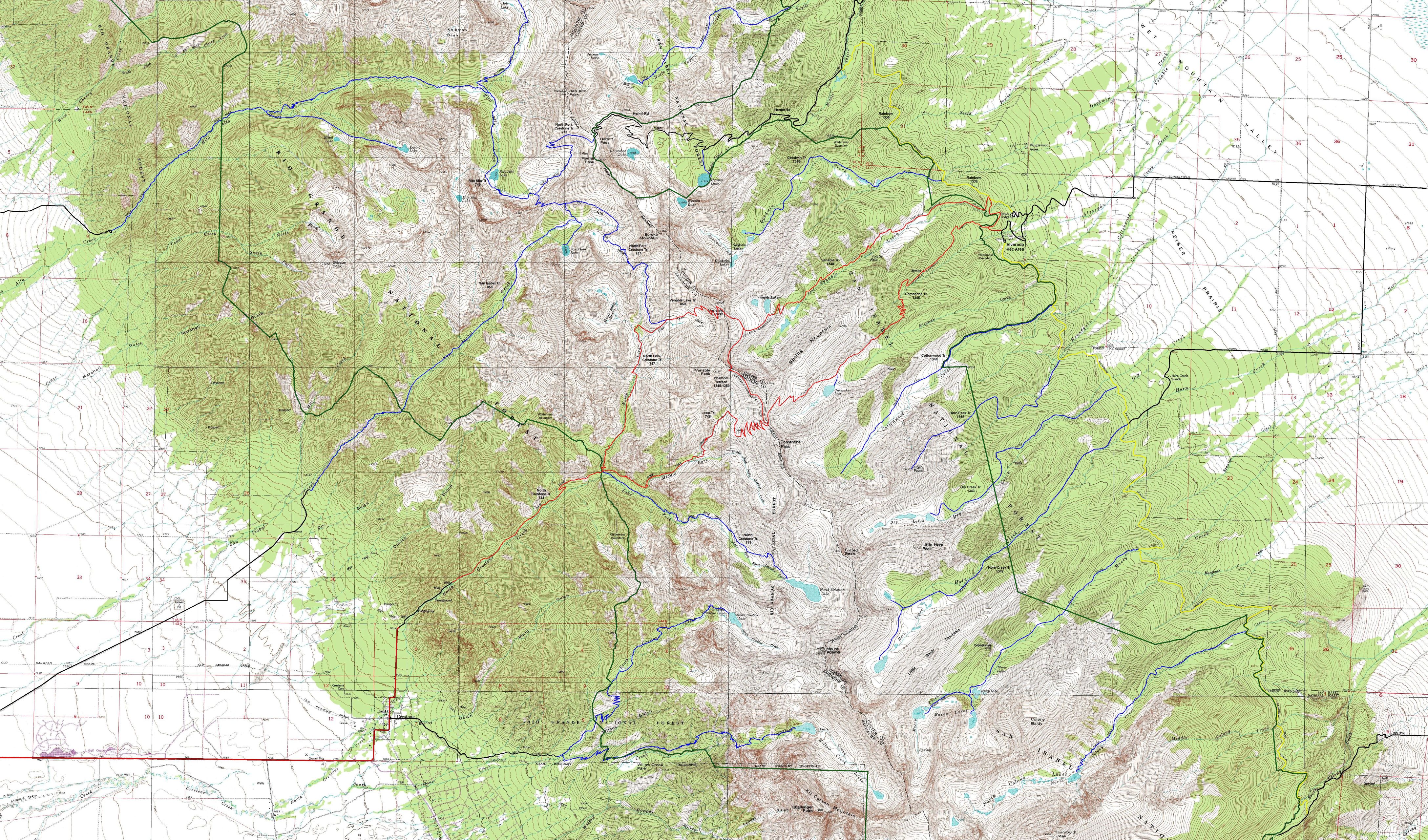
Comanche-Venable Loop, Sangre de Cristo Wilderness, Colorado.
Free downloadable topo maps. Available for purchase.
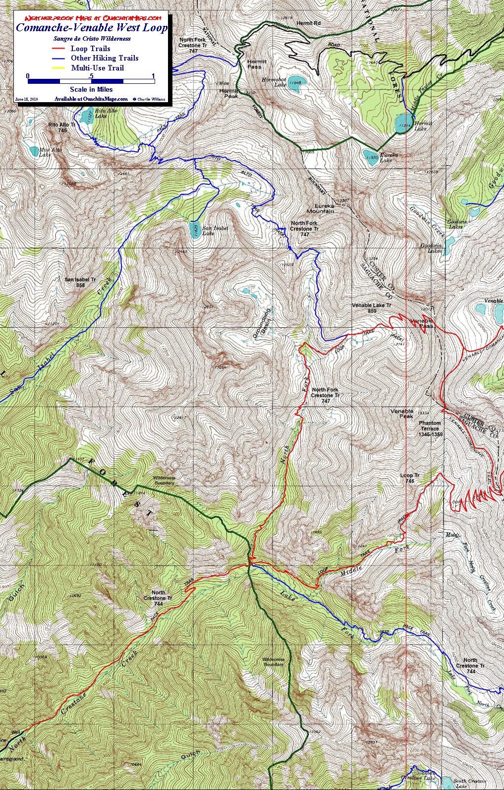
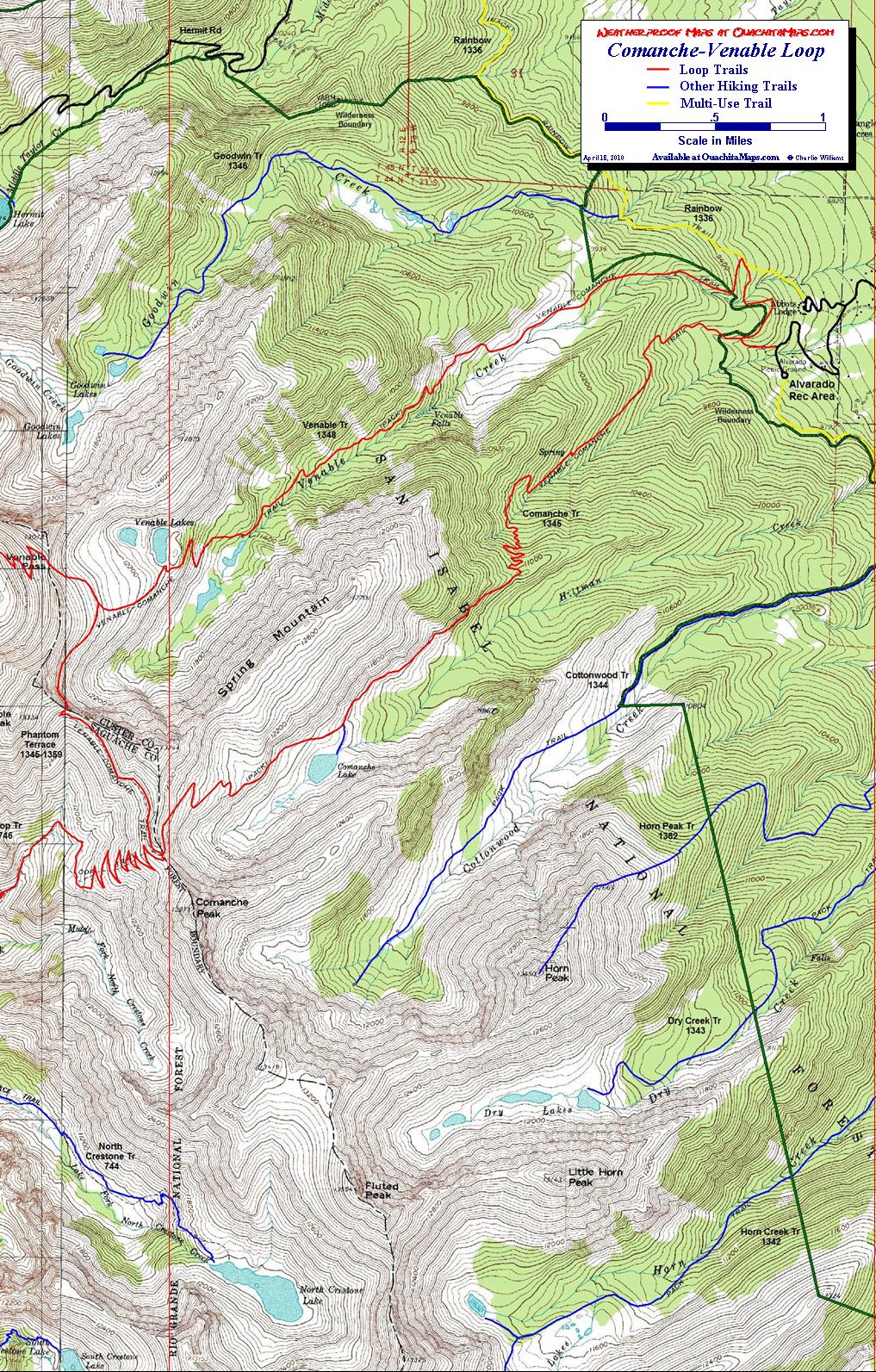
The Sangre De Cristo Mountains are a northwest-southeast trending spine in south central Colorado that features a series of northeast-southwest trending glacially carved valleys. While there are trails going up many of the valleys, these maps focus on one of the few "official" loops. There are two versions of the loop. The more popular east loop starts on the east side of the range at Alvarado Recreation Area near Westcliffe and uses the Comanche and Venable valleys to enter and exit the high country. Connecting the two, traversing the connecting ridge, is Phantom Terrace. Phantom Terrace is also the connector for the west version of the loop. It begins at Crestone Campground and uses the Middle and North Forks of Crestone Creek.
The Maps: There are 3 maps: one area map and two trail maps. They are available on this page as a downloadable jpg. The two trail maps are also available printed in color on 11x17, "Rite in the Rain” all weather writing paper for $5 plus S&H by emailing Charlie at cew5151@gmail.com. The maps are nominal 1:24,000 based on USGS 7.5 minute quadrangle topographic maps. The loop is shown in red. The yellow trail is the multi use Rainbow Trail, which is a necessary for many of the trails on the east side of the range. All other trails are blue. The green and black line is the wilderness boundary. The forest roads are in black and based on aerial and satellite imagery.