
Ridge Runner Trail, Mark Twain National Forest, Missouri
Free downloadable topo maps. Available for purchase.
The Ridge Runner Trail is a 22 mile point to point hike in southwest Missouri. It begins at Noblett Lake Recreation Area and ends at the North Fork Recreation Area. The trail overlaps with the Ozark Trail for about 6 miles and has several loop options. Our track of the trail is shown in red on the maps.
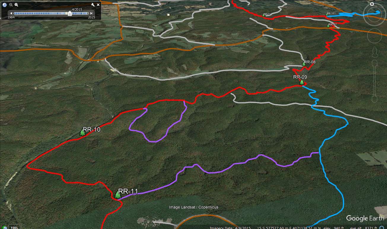
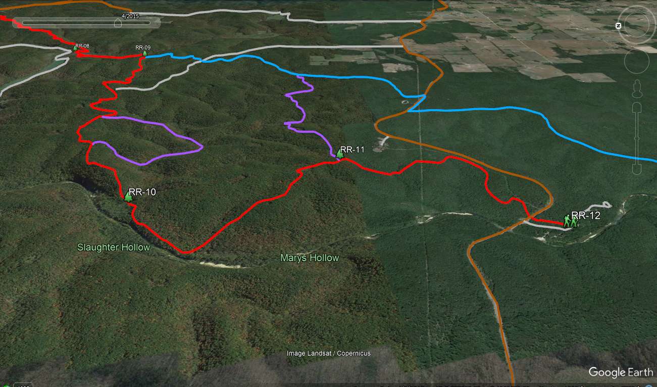
The Map: The trails are overlain on USGS 7.5 minute quadrangles with a contour interval of 20 feet. The red trail is the Ridge Runner Trail and was prepared using GPS data from our hike. While the map includes the Ozark Trail (blue) and other trails (purple), I have not been on them. The data from the Ozark Trail comes from the Ozark Trail web site, where you can find GPS data and maps of the entire Ozark Trail. This trail segment is part of the North Fork section. The Ozark Trail Association does good work, so the depiction on this map should be very reliable. The trails in purple are another thing. They were interpolated from the Forest Services map of the trail which looks like a reduced photo copy of the topo. The scale is too small to get a good rendering. Besides the official loop trails (Noblett, Short and North Fork), there is a 2 mile horseshoe in the Steam Mill Hollow area that represents a section of the actual Ridge Runner Trail that we skipped. It was getting late and my crew wasn't making very good time so we opted for the short cut. The Steam Mill Hollow section is also an interpolation from the Forest Service map. All the purple trails should be okay for planning, but not necessarily for navigation (I talked to a ranger and all the trails are open). If you spot any errors or have better data that you want to share, send me an email and I'll update the map.
Background: The trail is situated in the White River Hills ecological region of the Salem Plateau. The underlying rocks are Ordovician dolomites and sandstones. The plateau is highly dissected but the relief in the area is usually under a few hundred feet making the hike moderate to easy. The forest is oak (post, blackjack, white and black) with occasional short leaf pines.
GPS File: Right click this link to download the track in a gpx format. Save it to your computer and use your GPS software to load it to your GPS.
Google Earth Tracks: This link is to a Google Earth KML file for all the tracks on the Area map. You should be able to right click the file and save it on your computer. Then open it with Google Earth to see the entire wilderness trail system in interactive 3-D. Once in Google Earth you can access individual tracks. If you have the right software you can select the tracks you want and load them on your GPS.
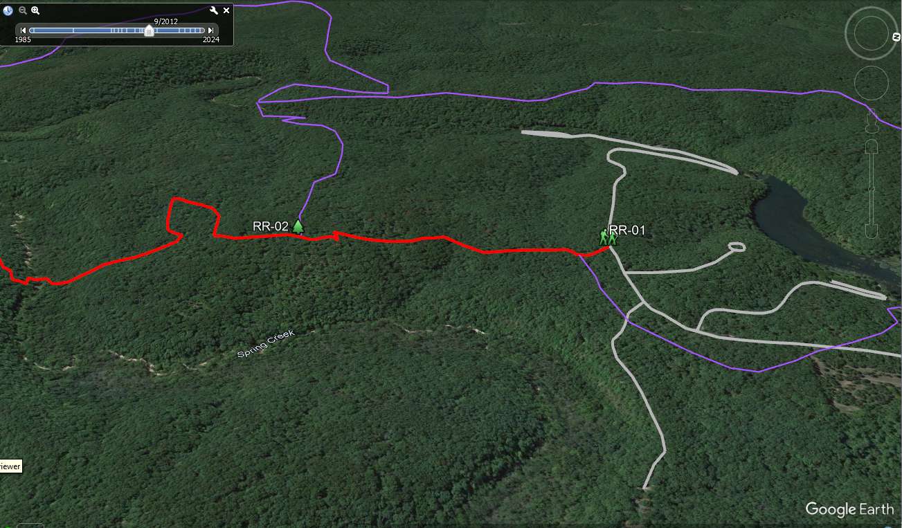
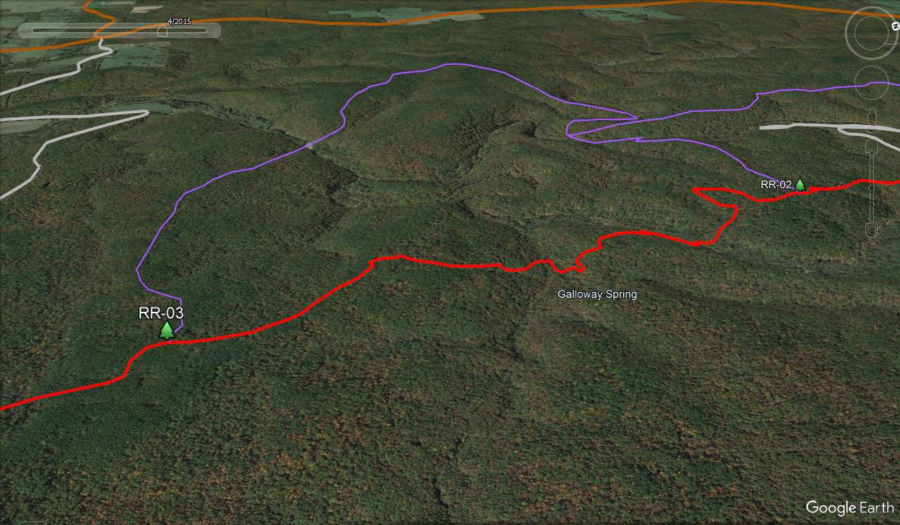
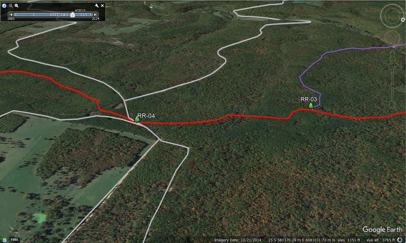
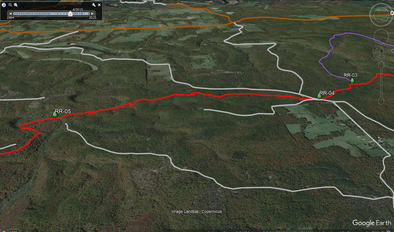
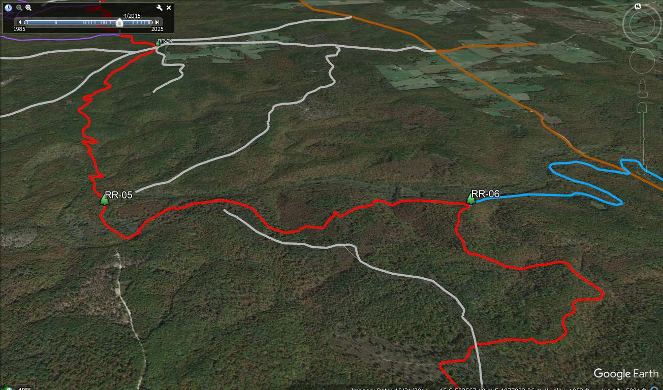
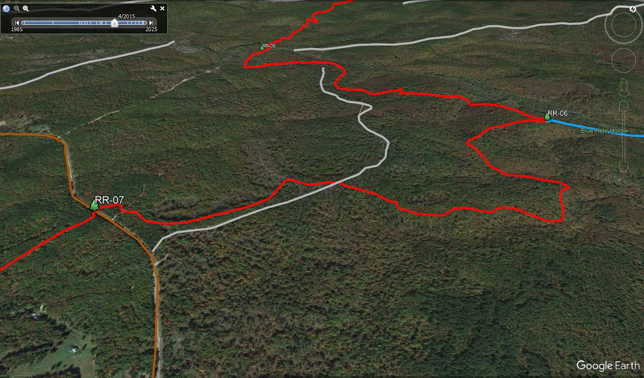
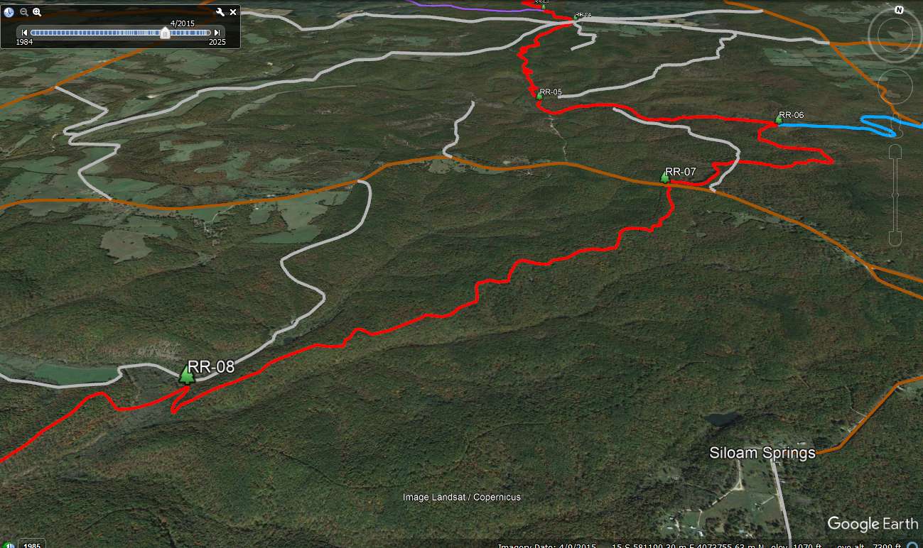
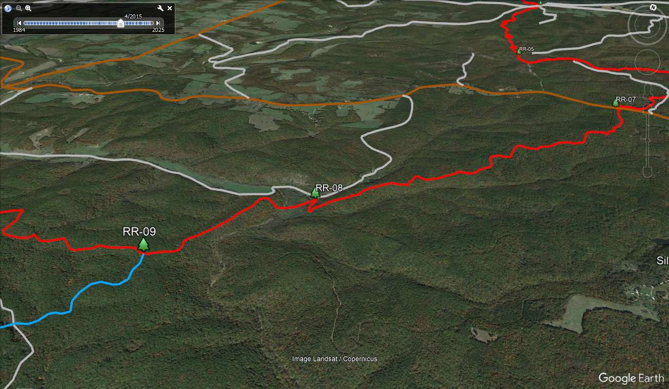
Google Earth Views: Using the above KML, the following Google Earth views illustrate the trail by highlighting the sections between wayponts. The Ridge Runner is in red. The lesser roads are gray. The main roads are brown. The Ozark Trail is blue and the assorted loop trails are purple.
- RR-01 to RR-02. Start at Noblett Trailhead and hike 0.6 miles to the Short Loop junction. The trail is fairly level crossing the top of the plateau.
- RR-02 to RR-03. Go south at the Short Loop junction, drop into Spring Creek, climb 130 feet over a ridge nose, descend into the tributary of Spring Creek and ascend 130 feet to the top of the plateau. Reach the Noblett Loop at 2.7 miles (cumulative).
- RR-03 to RR-04. The next .6 miles between the Noblett Loop and Forest Road 107 drops in and out of a depression formed by the upper reaches of an unnamed creek.
- RR-04 to RR-05. The Horton Trailhead is at FR 107. The trail stays high on the plateau for the next 2 miles then drops to a saddle at the end of Horton Hollow and finally hits bottom in Dry Creek. Another hill and back to Dry Creek at mile 6.0 (WP 05).
- RR-05 to RR-06. The trail works its way out of Dry Creek, ascends the nose of a ridge and climbs to the top of the plateau. It descends again to a small hollow that opens to a broad grassy valley and then climbs again toward the top of the plateau and the junction with the Ozark Trail (mile 8.0). Turn left (east) on the Ozark Trail to the Blue Hole Hollow Trailhead. Go Straight to follow the dual track of the Ozark Trail and Ridge Runner.
- RR-06 to RR-07. Except for a shallow dip into a hollow, the next 2.5 miles to Highway 14 is on the plateau. Cross FR 794 at 9.9 miles and cross Highway 14 at 10.5 miles.
- RR-07 to RR-08. The next 2.5 miles begins on top of the plateau and gradually drops until the final decent at Hay Hollow (mile 13.0). Hay Hollow Trailhead can be accessed via FR 769. North in the valley are Braddock Lakes.
- RR-08 to RR-09. Up a nose and along a narrow ridge is the junction where the Ozark Trail departs from the Ridge Runner (mile 13.9).
- RR-09 to RR-10. Except for a 130 foot up and down into a hollow, the red trail stays up on the plateau until it drops about 300 feet to the North Fork of the White River (mile 16.5). At 15.6, however, the full trail goes into a horseshoe that drops into Steam Mill Hollow and then back up to the top of the plateau to rejoin the red trail. The horseshoe adds about 2.5 miles to the hike but the mileage I use ignores it.
- RR-10 to RR-12. It is 3 miles to North Fork Recreation area. Follow the river and then up the plateau until the intersection of the North Fork Loop Spur that goes back to the Ozark Trail (mile 18.0). Down and up a hollow, around another and then a decent to the North Fork Recreation Area finishes off the hike.
Driving Directions: From Springfield, go 67 miles east on US 60 to Cabool MO. Go south on MO 181 for 15 miles to MO AP. Go southeast on MO AP for 3.1 miles to entrance to Noblett Lake Recreation Area.
Info: USGS 7.5 minute quadrangle topographic maps: Dyestone Mt, Siloam Springs and Dora (trails not shown). Contact Mark Twain National Forest, Rolla, MO, (573) 364-4621 or the Ava/Cassville/Willow Springs District, Ava, MO (417) 683-4428. Ozark Trail Association map page.
To Buy Maps: These maps are FREE. Click on image to access full size maps and download them. The entire trail is also available as a three map color set on weatherproof, Rite-in-the-Rain paper (11x17) for $5/sheet ($15 for the set) plus S&H by emailing cew5151@gmail.com.