Ozark Highlands Trail-Sylamore Section, Ozark Mountains, AR
Free downloadable topo maps. Available for purchase.
The OHT Sylamore Section is situated in the Ozark Mountains of Arkansas near the confluence of the Bufflo and White Rivers. The OHT trail is based on my GPS track of the trail. The roads are based on satellite images.
The Maps: Free full size versions of the maps are available on this page as a downloadable jpg. They are also available printed in color on 11x17, "Rite in the Rain” all weather writing paper for $5 per sheet plus S&H by emailing Charlie at cew5151@gmail.com. They are nominal 1:24,000 based on USGS 7.5 minute quadrangle topographic maps. The trail was mapped with a WAAS enabled GPS and is drawn in red. Also shown is the North Sylamore Creek Trail, in blue and selected roads. Other features include trailheads, segment mileage and waypoints.
GPS File: Right click this link to download the track in a gpx format. Save it to your computer and use your GPS software to load it to your GPS.
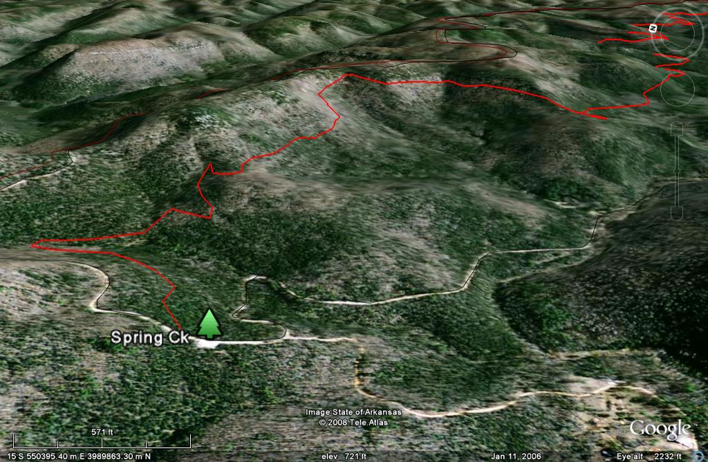
Google Earth Track: Right click this link to download the track in the Google Earth kml format and trace the route in interactive 3D. Save it to your computer and open it with Google Earth.
OHT Sylamore Section: The first map is the entire Sylamore section with the trail shown in red. This map is supplied to assist with your trip planning and is not available for sale. It is 16mb so the download may be slow. The ready-to-Print maps follow and are formatted to print on 11x17 paper. They are also available for sale.
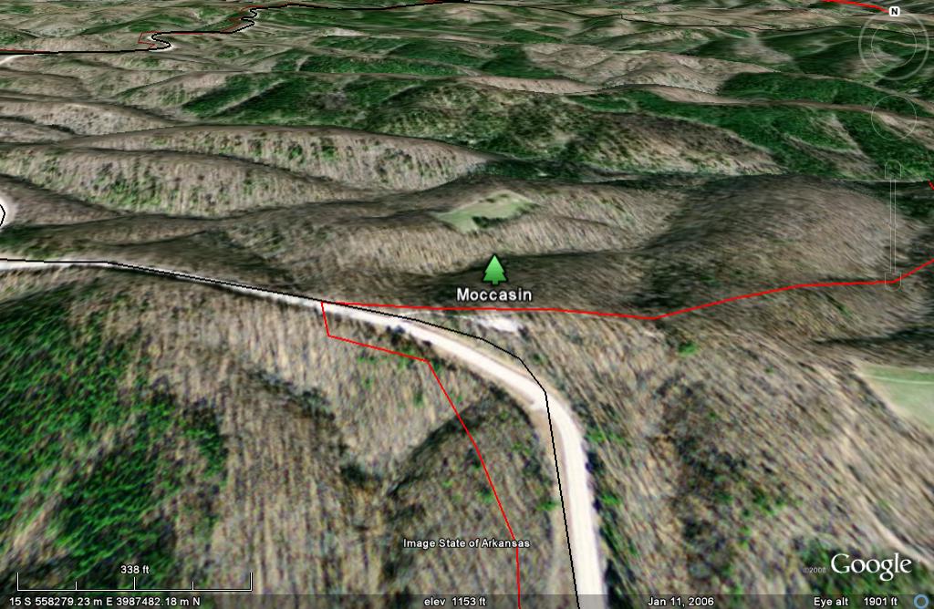
The trail begins at the Spring Creek Trailhead on the very west side of the Spring Ck-Moccason Ck map. It is accessed by the Spring Creek Road from Big Flat and Highway 14. The trail follows the base of the escarpment north of Spring Creek to AR Highway 341. Across the highway is the Moccasin Springs Trailhead.
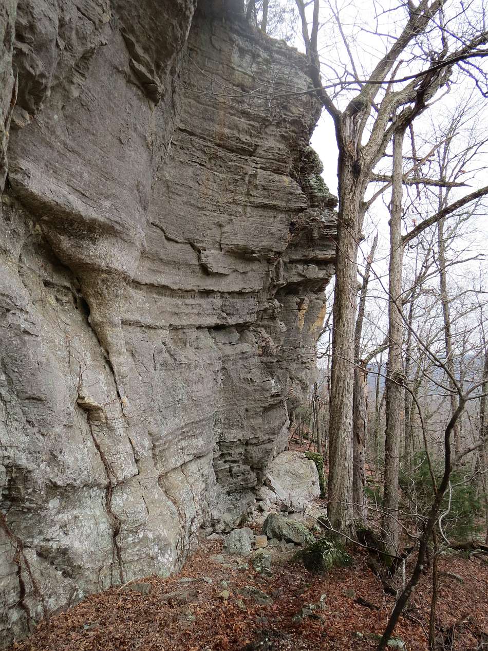
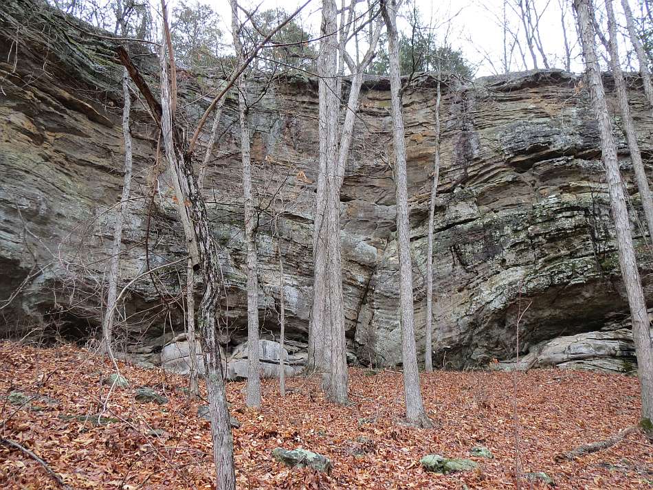
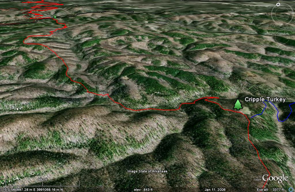
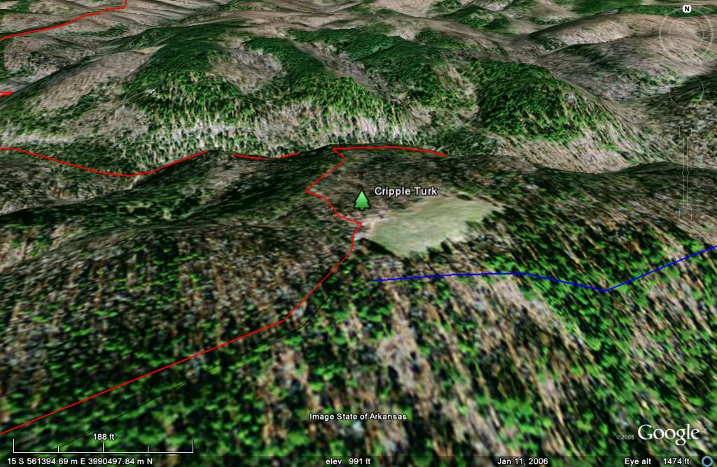
About a mile past the trailhead, the trail enters the Cripple Turkey Map at the middle of the west edge. In another mile it leaves Cap Creek and heads north to the Barkshed Road. The trail follows the Barkshed Road for 1/3 of a mile and then veers north east following the Cripple Creek Road. In another mile is the Cripple Turkey Trailhead. This is also the begining of the North Sylamore Creek Trail, shown in blue. It beautiful with its crysal clear water and massive sandstone bluffs. The OHT continues NW from the trailhead, crosses the Baxter-Stone County line and leaves the Cripple Creek Map.
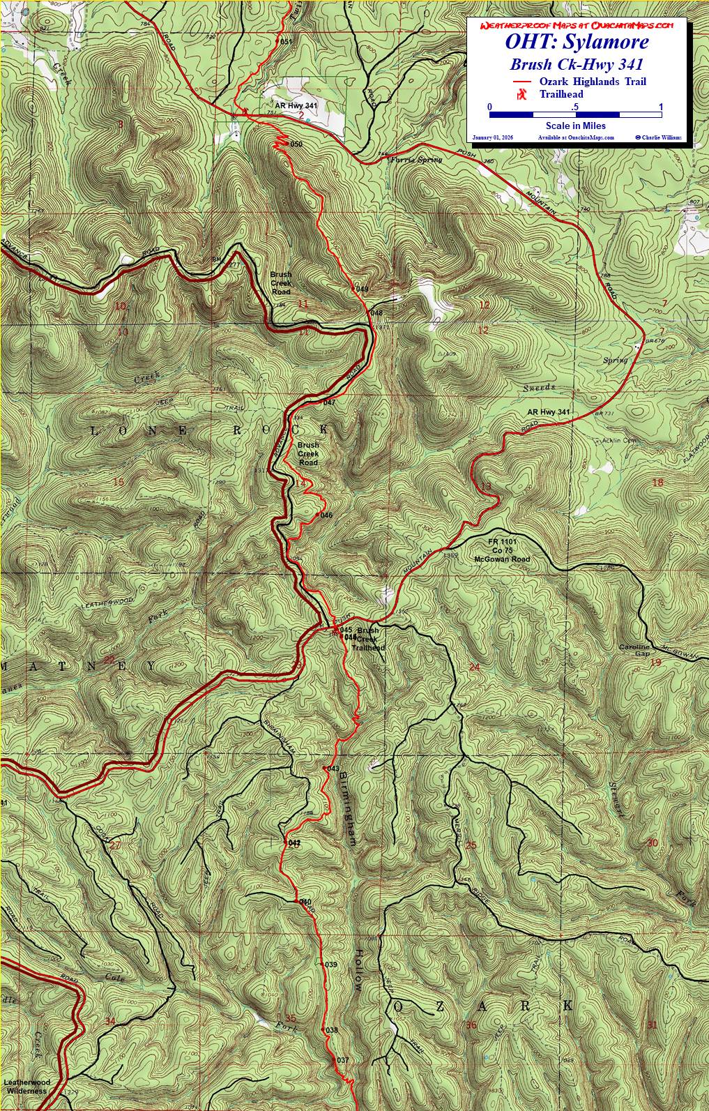
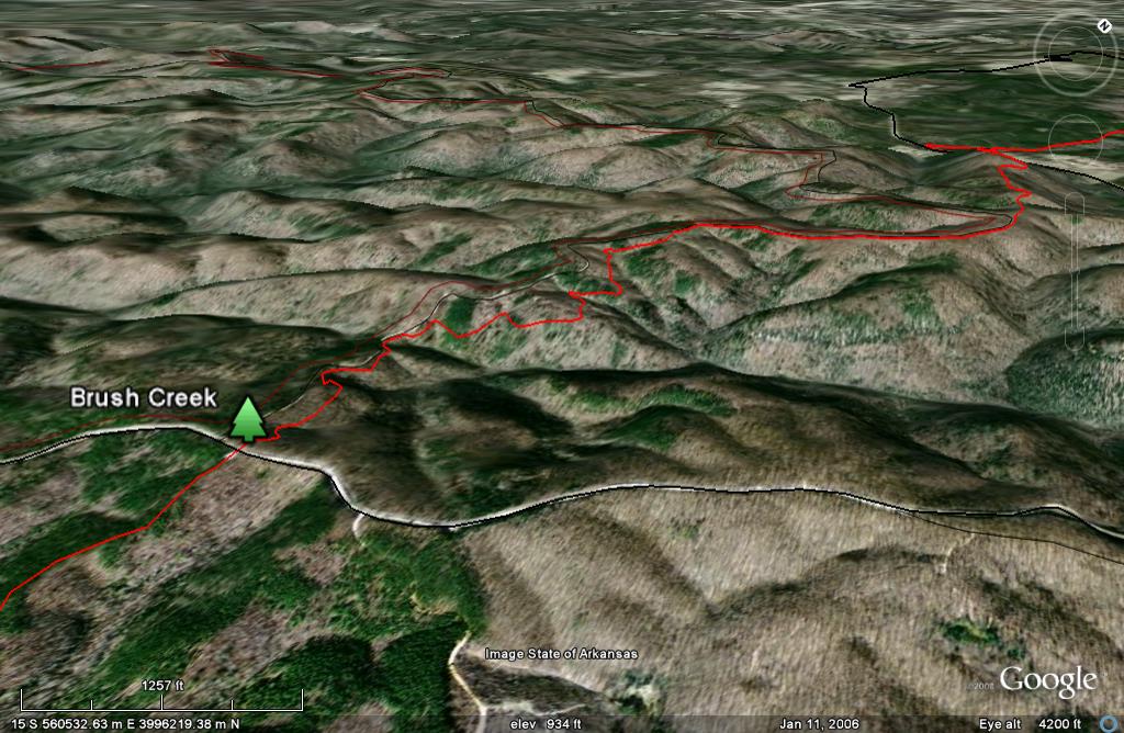
The next map is the Brush Ck-Hwy 341 map. The trail leaves Birmingham Hollow and tracks north on the west-adjacent ridge to the Brush Creek Trailhead. It crosses AR Hghway 341 and follows the Brush Creek Road and eastern boundary of the Leatherwood Wilderness for a couple miles. When the road and wilderness boundary curve to the west, the OHT continues north. It stays on a ridge for a couple mile then drops down on switchbacks to cross AR Highway 341, again. The trail heads NNE for another mile and leaves the map.
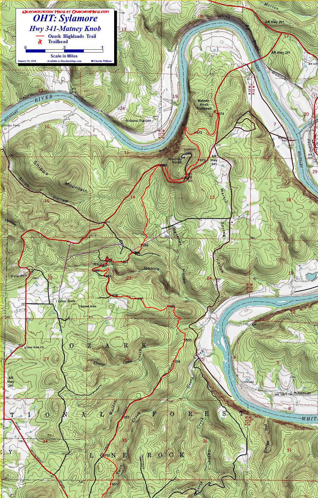
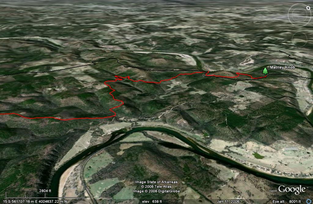
The last map is Hwy 341-Matney Knob. The trail stays on high ground with Twin Creek below to the east for about 3 miles. It drops into Flower Creek, climbs another ridge and turns west. After crossing Rough Hollow the trails winds around the sides of some other hollows and crosses AR Hghway 341. In the next mile and a half, the trail wraps around Matney Knob and ends at the Matney Knob Trailhead on Highway 341.
Access to the trail is by Highway 341. Taking it north crosses the White Rive bridge to Norfork AR. Taking it south it winds around the area of the trail, passing the trailheads mentioned above. At the very very SE corner of the Spring Ck-Moccasin Ck map, 341 can be seen (un-labeled) as short red east-west line where 341 is leaving the map.
Info: Ozark-St. Francis National Forests, Russellville, AR, (479) 964-7200. Sylamore Ranger District, Mountain View, AR, Phone: (870) 269-3228.
Free Map. Click on the map image and it will load a full size, 1:24,000 scale version on you browser. It is sized to 11 x 17 inches. Download it and print it on you own computer.
To Buy Maps: The entire trail is on four maps. Color, 11x17 maps on weatherproof paper are available for $5 each ($20 for the set) plus S&H by emailing Charlie at cew5151@gmail.com (copy and paste in your email).