Grand Canyon: North Rim to South Rim, Arizona
Free downloadable topo maps of the North Rim to South Rim
Printed maps are also available for purchase.
NOTE-The Dragon Bravo Fire on the North Rim of Grand Canyon National Park burned down the North Rim Lodge and the surrounding 500 acres. Many of the trails were closed. Camping is by permit only so check with the Park before you start your travels. The Park is also doing work on the water pipeline and has closed the River Trail and Silver Bridge. Check their website for updates.
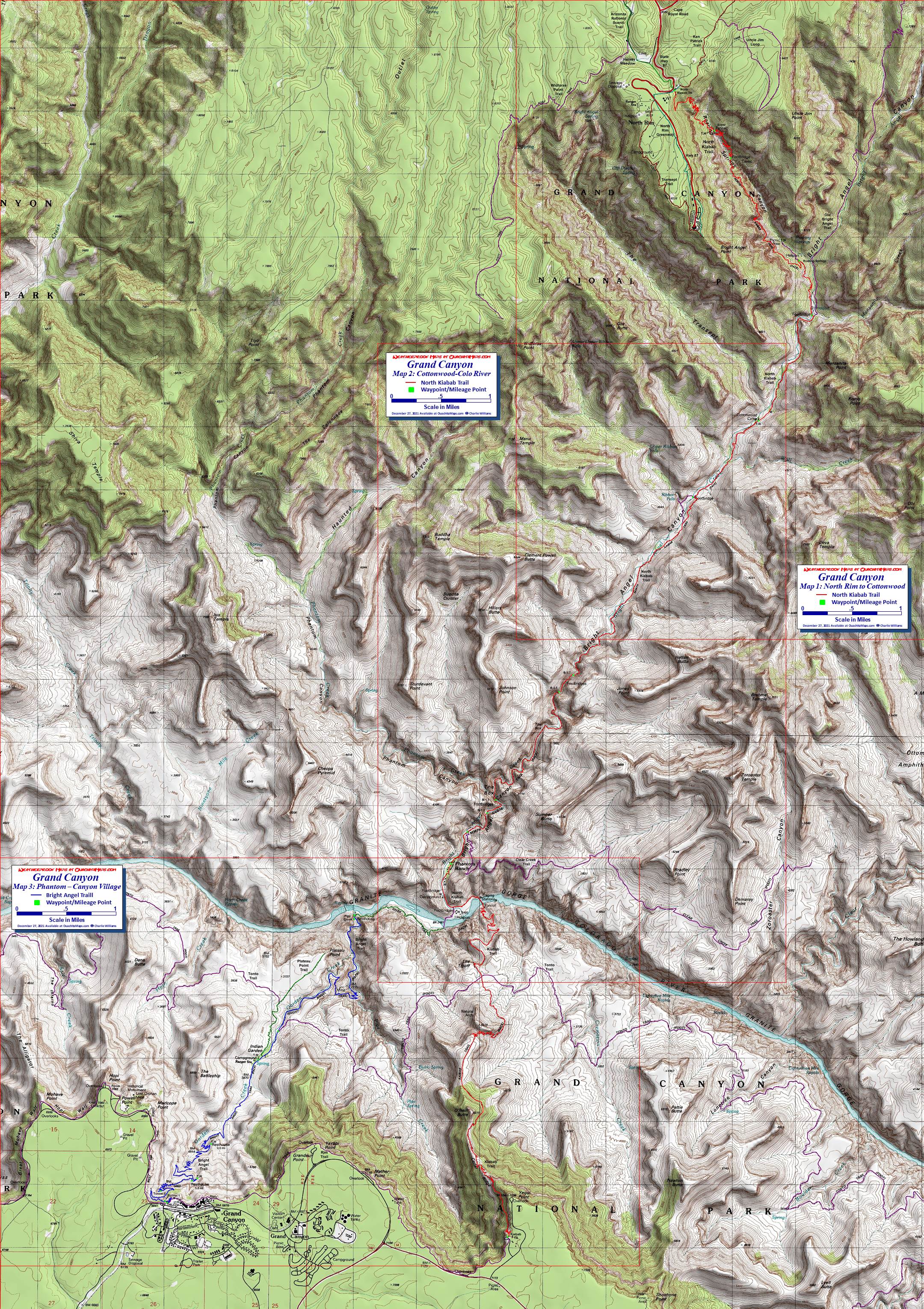
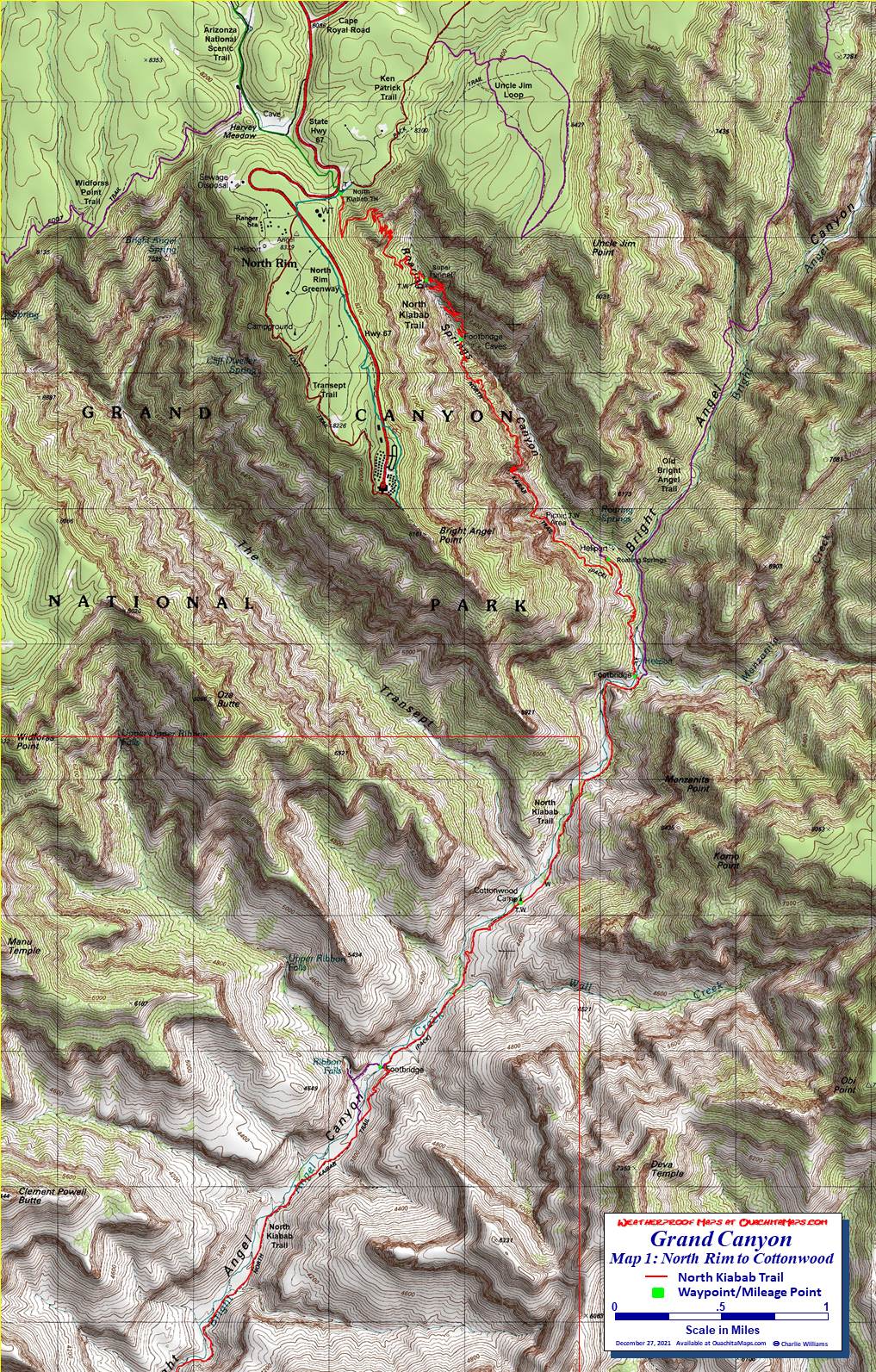
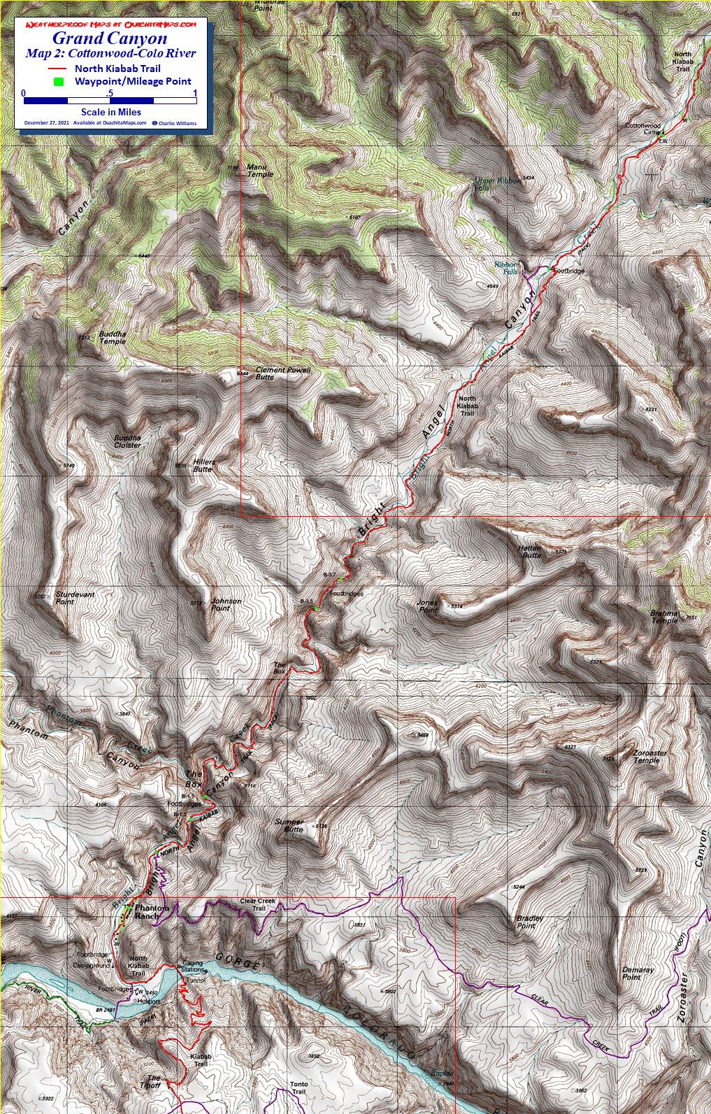
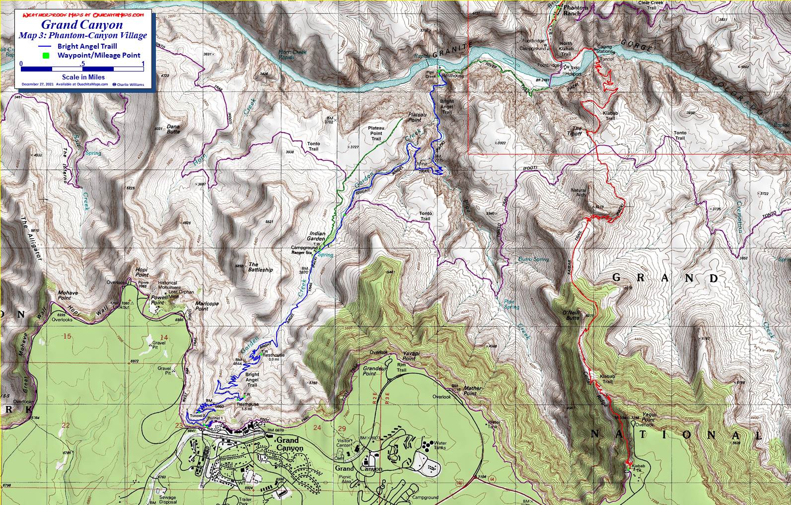
There is every reason on earth that the Grand Canyon is a national park. It is 1,904 square miles and has 595 miles of trail. Established in 1919, I have two questions. 1) What took so long? and 2) When the first settlers got there did the say “oh my god it’s amazing” or “oh crap, how are we going to get across?” This page describes the geology along the Bright Angel Trail and 3 trips to the canyon. Since the canyon is all about the rocks and cliffs, I felt the geology section should come first to give you an idea of what makes this park so special. With apologies to the North Rim to South Rim hikers, the geology section uses the trip from the South Rim on the Bright Angel to the River Trail.The Maps: There are 4 maps: one area map and three trail maps. They are available on this page as a downloadable jpg. The three trail maps are also available printed in color on 11x17, "Rite in the Rain” all weather writing paper for $5 plus S&H by emailing Charlie at cew5151@gmail.com. The maps are nominal 1:24,000 based on USGS 7.5 minute quadrangle topographic maps.
Want to do some trip planning? This link is to a larger map that encompasses this trip and some of the surrounding area. (it is 1.9 mb so it may be slow to download). A preprinted version of this map is NOT available.
Geology of Bright Angel Trail
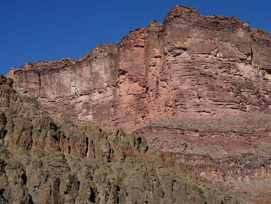
The Grand Canyon Village and trailhead are at just over 6800 feet sitting on the Kaibab Limestone. The trail descends through the Garden Creek Canyon which was formed due to a weakness in all the rock units caused but the Bright Angel fault.
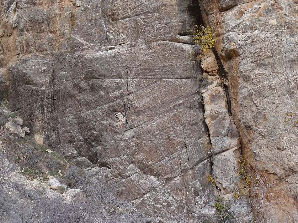
The Kaibab is a 270 million year old (my) shallow marine layer that is a cliff former and about 300 to 400 feet thick. About 500 feet past Tunnel 1 you cross the Bright Angel fault. Crossing the fault puts you on the 275 million year old Toroweap formation. After the trail switch-backs to the east, it crosses the fault again putting you back to the Kiabab. A little further down the trail you are back in the Toroweap. The Toroweap is also Permian and about 200 feet thick. Due to the mix of shallow marine lithologies (gypsum, sandstone, shale and limestone), it forms slopes on the canyon wall.
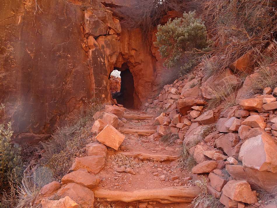
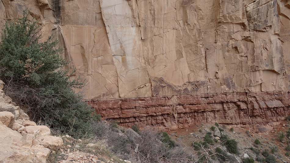
Just past Tunnel 2 the trail hits a cliff made of Coconino Sandstone. At 280 million years, it is older than the Toroweap but still Permian. With its large-scale crossbedding it is interpreted as desert sand dunes. The best place to see it is from the switchbacks just below Tunnel 2. Look across the drainage to the west; it is the tan-to-white colored cliff at your eye level. When the trail straightens out it is the cliff above you.
After the switch-backs, the trail is on the 285 my Hermit Shale. The lithology is shale, siltstone and very fine-grained sandstone that is a softer rock and easier to erode than the sandstone and limestone cliff formers. As such, the canyon wall below the Coconino cliff is sloped. When fresh, the color is red from the iron oxide present. However, it weathers tan. It was deposited in a coastal plain. The thickness is about 400 along the trail.
Below the Hermit is the Esplanade Sandstone. Often considered the top unit in the Supai Group, it is early Permian about 290 my. The unit consists of a couple alternating cliff and slope sections making it harder to differentiate on the trail. However after you pass the first resthouse and the trail turns back to the west you will be on the Esplanade. The trail crosses the fault (as defined by Garden Creek), goes north to the 5400 foot contour, goes south back to the fault and crosses to the east. After crossing the fault the trail follows the Esplanade but it is now above you. The depositional environment is considered coastal aeolian.
Below the Esplanade the trail begins a series of tight switchbacks that are underlain by the rocks of the Supai Group. As the trail approaches the 3 mile resthouse it crosses to the Surprise Canyon formation. The Supai Group are red Pennsylvanian fine clastics (shales to sandstone) formed in shallow marine and coastal environments. It is about 600 feet thick and ranges from 300 to 320 my. It is both a cliff former and slope former; on the trail is seems to be predominately a slope former but there are some minor cliffs on the walls away from the trail.
The Surprise Canyon Formation is Mississippian age, about 325 my. It is limestone, shale, sandstone, and conglomerate with the coarse conglomerate components being derived from the Redwall Limestone below. The formation was deposited in paleovalleys in the Redwall. A combination of the unconformable surfaces with the Supai above and the Redwall below and the colluvium from the Supai slope, makes identifying the Surprise Canyon Formation on the trail difficult. It is mapped as being at the 3 mile rest house.
The 3 mile resthouse sits on top of the Redwall Limestone. The Redwall is 500 to 600 feet thick and a major cliff former. The trail follows a colluvial slope below the resthouse avoiding any precipitous drop-offs. As the name suggests, the rock is a red, iron-stained limestone. As a fossiliferous limestone it was deposited in a shallow marine sea. It is about 340 my and is unconformable with the Sunrise and Supai above and the Mauv Limestone and Temple Butte Formation, below.
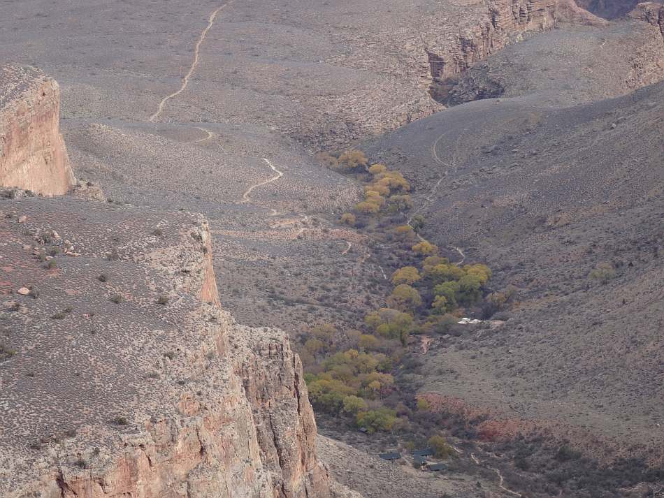
After passing through the Redwall, the trail starts to level off and enter the Garden Creek valley. Less than a mile further is Havasupai Garden. You are now in the Tonto Group. Due to the unconformity, the rocks are Cambrian and about 500 my. The top layer here is the Mauv Limestone, but it is covered and not evident to the casual observer. Below the Mauv is the Bright Angel Shale which is covered and just looks like desert scrub. If you walk out to Plateau Point that is what you are on. If you take the Tonto Trail to the Kaibab Trail, you will be on the Bright Angel Shale most of the time. The unit is green or purple fine grained clastics deposited in a shallow sea.
As you descend out of Havasupai Garden, the small canyon is lined with the Tapeats Sandstone. It is a 200 to 300 foot thick cliff-former interpreted and coastal to shallow marine. The medium to coarse grained sandstone features cross bedding and in many places a conglomerate layer from the erosion of the Precambrian basement rock below. This ends the sedimentary rock. No more layer cake geology.
Below the Tapeats are the two Precambrian units. The Grand Canyon Supergroup is comprised of sedimentary layers ranging from 800 my to 1.2 by. They are different from all the sedimentary layers above because they were uplifted and tilted before the deposition of the Tapeats and subsequent units. They are not present on the trail to the river but can be seen north of the Colorado River as the lower cliffs on the Cheops Pyramid and Isis Temple and the upper cliff above the Colorado River below the Cheops Pyramid. If you go to Plateau Point, they are the sedimentary layers directly above the Vishnu Schist. If you go to Cottonwood Campground on the north side of the river, it starts to appear north of the 3.7 mile footbridge. Ribbon Falls tumbles down the Shinumo Sandstone member of the Super Group.
Below the Supergroup, and in many places in direct contact with the Tapeats, are the crystalline basement rocks. Generally called the Vishnu Schist, it is a 1.4 by to 1.8 by metamorphic complex made up of schists and igneous rocks such as the Zoroaster Granite. It is best seen in the river gorge lining the sides of the canyon. The rocks below Plateau Point and across the river are Vishnu. About 0.6 miles from Havasupai Garden Campground on the way to the river, the trail drops below the Tapeats into the Vishnu. If you can’t see a bedding plane, it is Vishnu.
The last point to be made is the Great Unconformity. The bottom of the Tapeats is very irregular because it is resting on rocks that are a billion years older. When there is a break in deposition of a sedimentary rock sequence it is called an unconformity. Usually these are much smaller breaks like going up from the Redwall to the Surprise Canyon Formation. As a limestone the Redwall was deposited in a marine environment. Uplifting occurred so that the top section was erode and the coastal Surprise Canyon sandstone was deposited. While there were millions of years involved in the sequence, the rock layers still look like a layer cake and the Surprise beds are parallel with the Redwall.
The Great Unconformity represents different eras. The Vishnu was formed through continental collisions, mainly when volcanic island arcs collided with the proto-North American continent 1.8 by ago during the formation of the Nuna supercontinent. The collisions formed mountain ranges as tall as the Cascades but over a billion years of erosion and tectonic activity the ancient mountains got to sea level where the Tapeats could scour them more and, from the additional weight, pushed them below sea level. Once at sea level, the other layers (Tapeats through Kaibab) would continue to deposit and push the Vishnu deeper. It was the uplift of the Colorado Plateau during the Laramide orogeny that formed the Rocky Mountains that pushed up all the mentioned rocks so that they could be eroded into the Grand Canyon.
Also involved in the Great Unconformity is the Supergroup (though geologist start to introduce the term Great Nonconformity). About 200-400 by after Nuna formed, it began to rift apart. The Supergroup was thought to have been deposited in a rift valley, on top of the Vishnu complex. As sedimentary rocks, they were deposited at or below sea level in horizontal layers. With the eons of separation from the Vishnu, the contact was an unconformity. After the rifting, the continents began to comeback together forming the Rodinia supercontinent. This series of continental collisions likely cause the uplift and tilting of the Supergroup rocks. It was on the tilted Supergroup and the Vishnu that the Tapeats was deposited.
North Rim to South Rim Hike
Trail Mileage Table: A trail mileage table is presented in pdf format. It begins at the North Rim Lodge (which burnt down in 2025 in the Dragon Bravo fire), follows the North Rim Greenway to the North Kiabab Trailhead, and then makes the travese to the south rim. Each points is displayed with a green square on the maps. Mileage and elevations are provided.
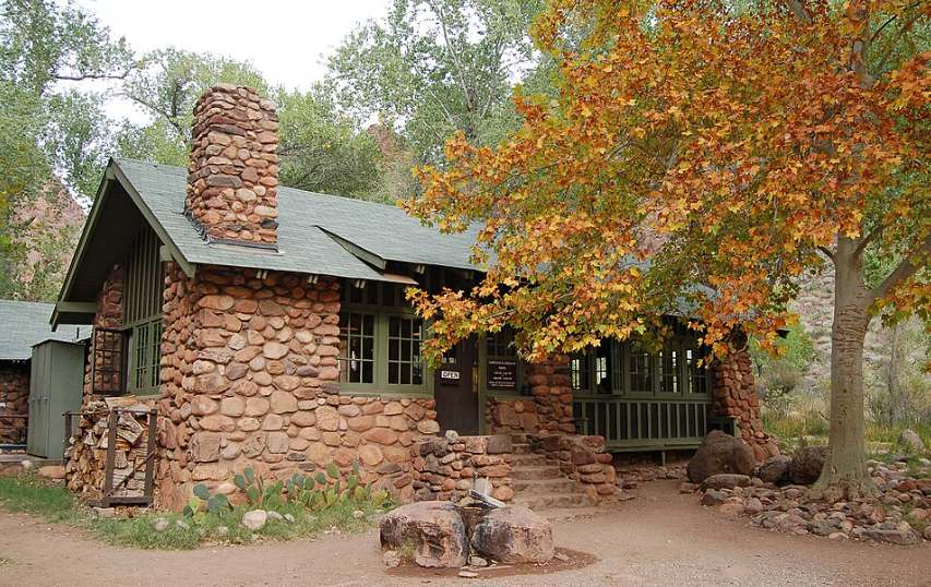
The Hike: A few years ago, I got a call from Robin asking if I wanted to go with him on a bucket list hike to the Canyon. It was the Rim to Rim, north to south. This hike uses the two most popular trails, the Bright Angel and the Kiabab. While they can be used as down and back hikes from either rim to the Colorado River, this map and the accompanying trail mileage sheet, were created for a hike from the North Rim to the Grand Canyon Village on the South Rim. This traverse of the canyon is officially 21 miles.
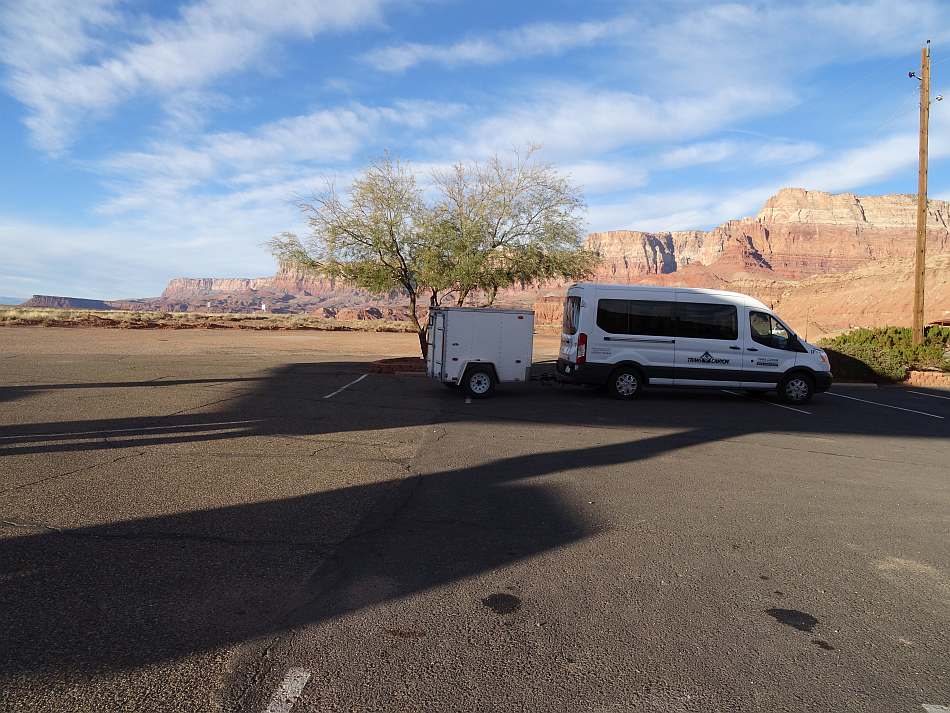
To do this hike, you have to work out the logistics of getting to the North Rim. We used the Trans-Canyon Shuttle service. This was a couple days after Thanksgiving and this year the last shuttle for the season. A few days later, Highway 67, the access road to the North Rim closed for the season. The shuttle picked us up in the dark at 6am at Bright Angel Lodge. It was a full van and since most of us were doing the Rim to Rim we saw some of them again. One guy was going back to his car after a bare-foot rim-to-rim the previous day. It takes a village to make an idiot.
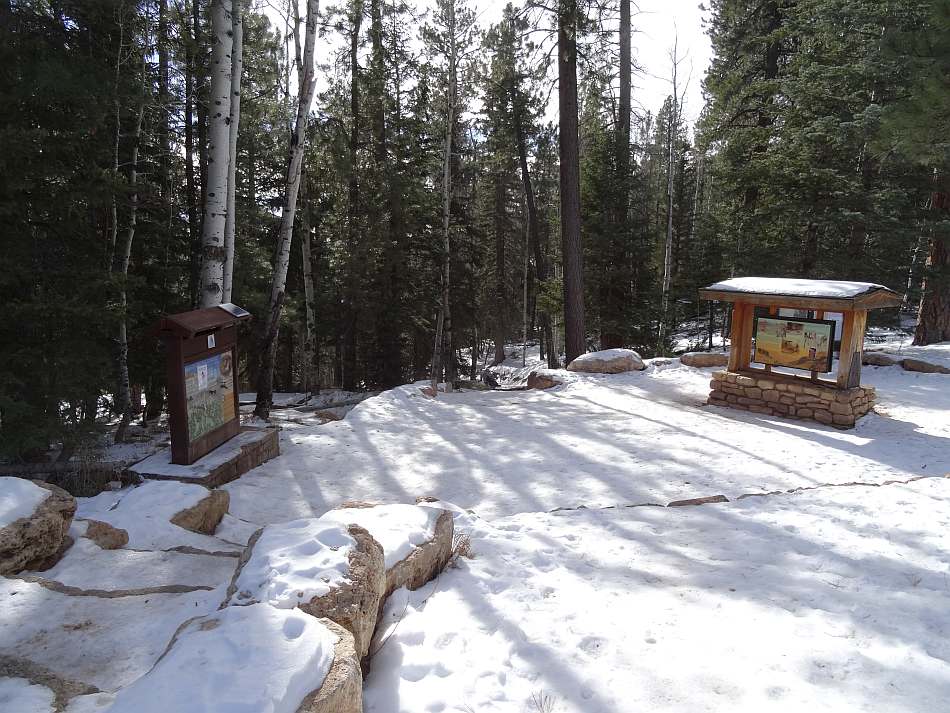
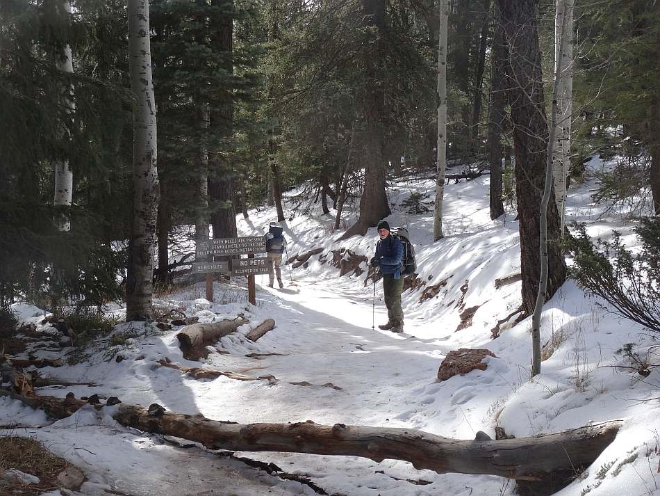
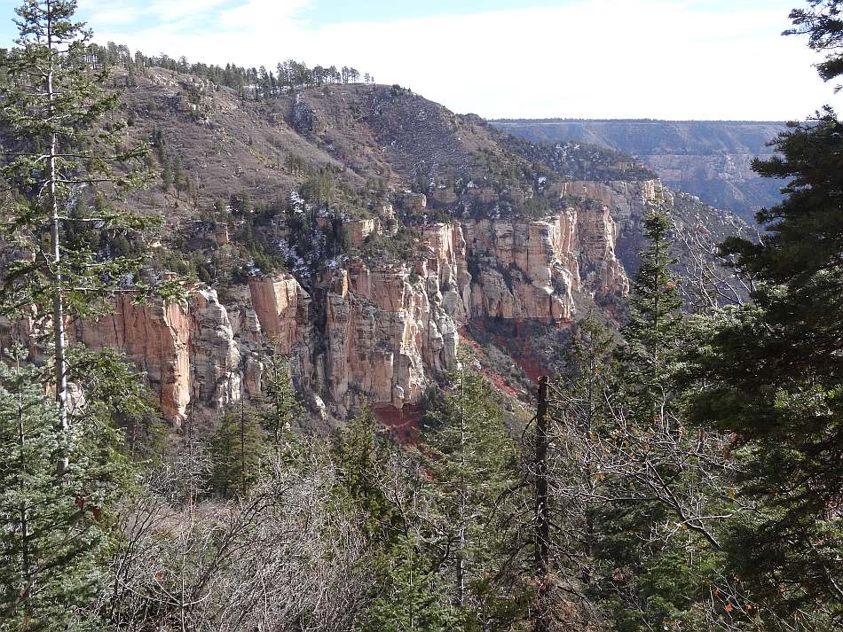
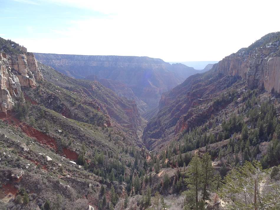
The van dropped us at the trailhead parking lot, elevation 8,250. They had had quite a bit of snow the week before so we started the hike with our Yak-Traks on. Although the trailhead is in the Kaibab at the top and passes through the Toroweap, the most obvious rock unit at the start of the hike the white Coconino Sandstone which can be seen ringing the upper part of Roaring Spring Canyon. By the time we got to the switchbacks through the Coconino, we were out of the snow. The sandstone cliff provided a great view of the Roaring Springs Canyon below.
About 1.7 miles down the trail and an elevation drop of 1,400 feet is the Supai Tunnel . It was blasted through the Esplanade Sandstone member of the Supai Formation in the 1920s. There is a small rest area, toilet and water. However if you are depending on the water, check ahead and make sure pipeline and pump system are fully functional.
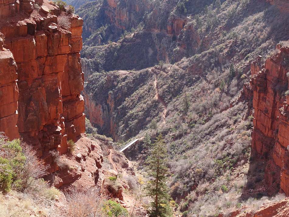
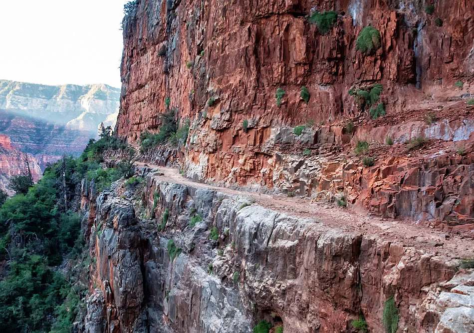
The Redwall Bridge over Roaring Springs Creek is a mile further, 2.7 miles from the trailhead. On the trail, you reach the Redwall formation and switch-back down 100 feet to the bridge. Then you climb a 150 feet over 0.2 miles and the trail levels out. For the next mile-plus the trail is on various bedding units of the Redwall with a 400 to 500 foot cliff dropping off to your left and a cliff above. To say it made me nervous would be an understatement.
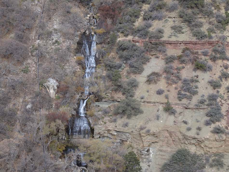
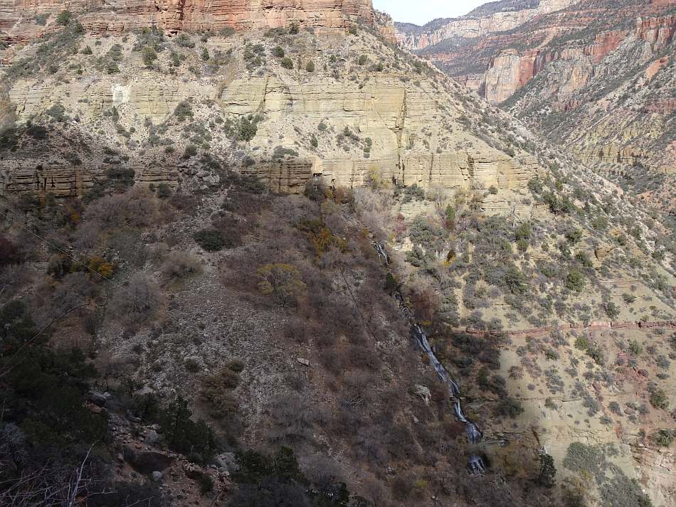
At about 4 miles from the top, the trail is across from Roaring Springs . The source of the springs is a huge cavern fed by the karst network in the Redwall, Mauv and Kaibab Limestones. The Kaibab waters percolate through the dense sandstones (e.g. Coconino) along faults and fractures. Below the springs is a helipad and pump house. The pump house is part of the 12.5 mile Trans Canyon Waterline (TCWL) that supplies water to Cottonwood Campground, Phantom Ranch, Supai Garden and even the South Rim. The pipeline follows the trail and when we were there before the major rebuild in 2024-2026 there were areas where it was visible on the path. Also in the Roaring Springs area is the Manzanita Rest Area. It is 5 miles from the trailhead next to the pump house residence. There is a toilet available at the rest area. Just past the rest area is the footbridge that takes you to the east side of Bright Angel Creek.
Cottonwood Campground is a mile and a half further. There is one group site and about a dozen individual campsites branching out along both sides of the Kaibab Trail. They are compacted dirt pads with a picnic table, hanging bar and food box. Due to the number of visitors and the fact the sites are fixed, rodents are present. Put all your food and toiletries in the box and hang your pack from the bars. There is a composting toilet but due to the construction work on the TCWL we had to get water from Bright Angel Creek. The tent pads are level but because they are so compacted we had difficulty putting in stakes. We use shepherd hooks and if I had known I would have brought a 4 inch nail to start each hole and pound it in with a rock.
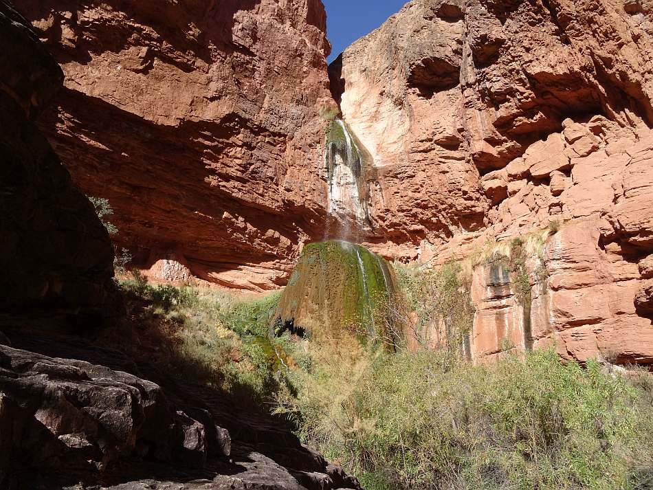
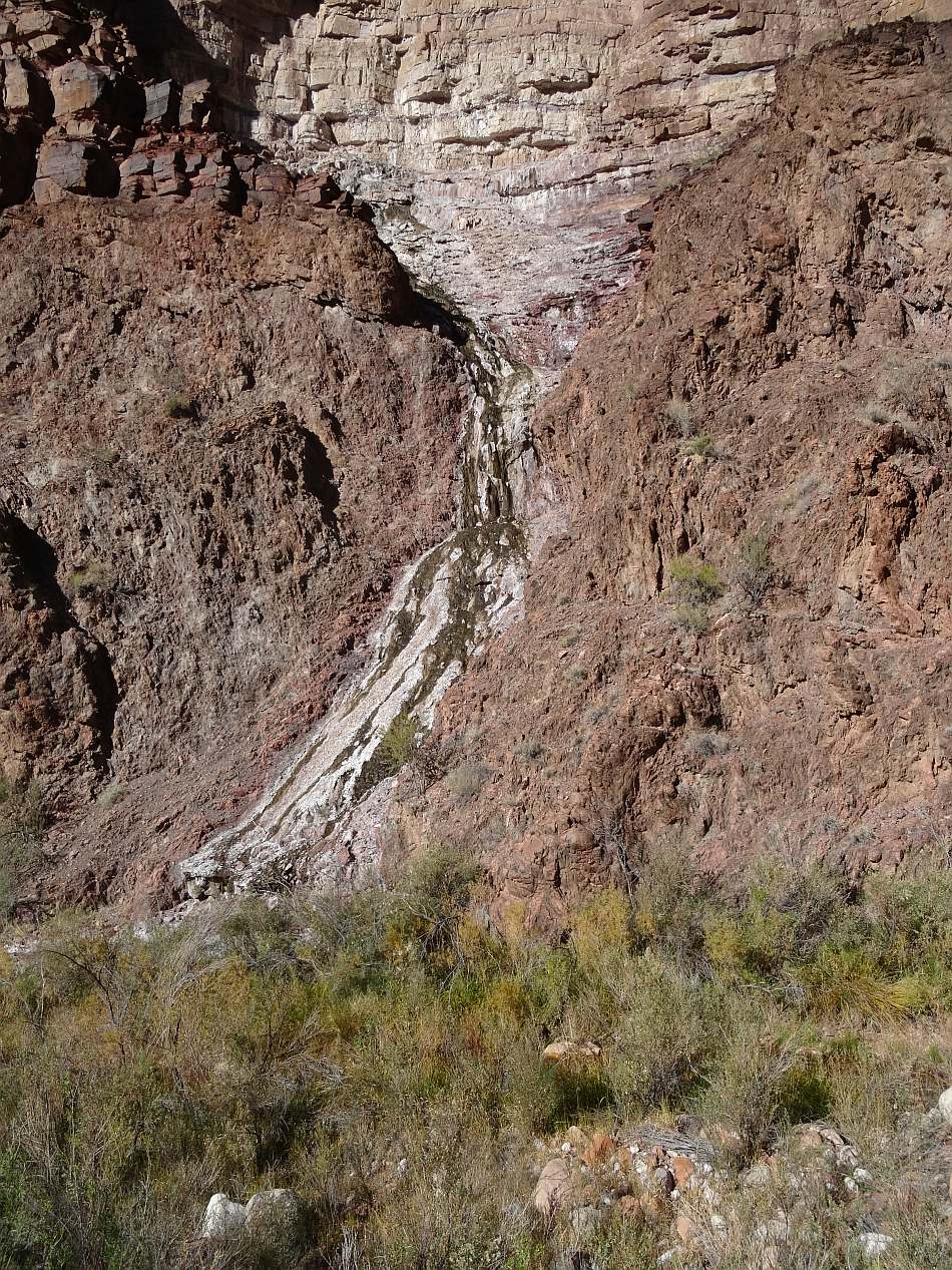
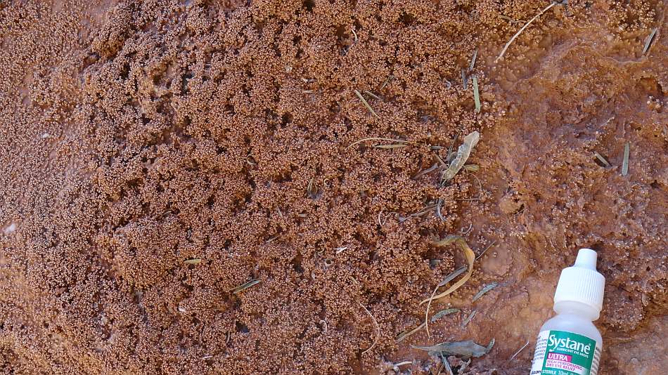
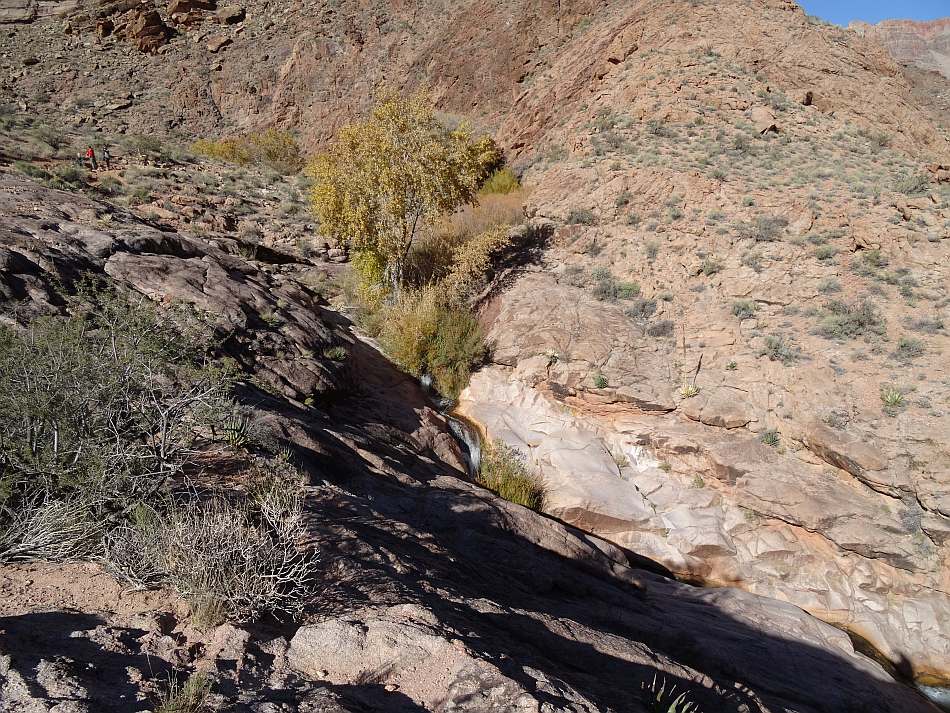
Our second day was a quick 7 miles down grade to Phantom Ranch and Bright Angel Campground. We stopped at Ribbon Falls, about a mile from Cottonwood, and hiked to the lower falls. The Grand Canyon is all about grandeur but there are many little things that are special and get overlooked. There are two at the falls. First, look at the big moss covered mound at the bottom of the falls. This is made of travertine. The water in the valley above dissolves calcium carbonate (CaCO3) out of the limestone units (e.g. Redwall, Mauv, etc). When the water hits the mound, evaporation takes place and the CaCO3 come out of solution reforming into a type of limestone called travertine. It is like the limestone that forms stalactites and stalagmites in caves. The second is tufa. Look around the mound and you will see a delicate crust of limestone on the ground. It is caused when the CaCO3 rich spray from the falls evaporates. It is the same process and mineral as the travertine but the spray makes it form differently.
The bridge to the falls was taken down in 2021 so it was a wet water crossing to get to it. We were only going to be gone a few minutes and made the mistake of leaving our packs at the crossing. When we got back, a bird had pulled a snack out of a pack pocket. I know better but wildlife will take advantage of any lapse in judgement. My bad!
Phantom Ranch consists of a canteen and cabins. A little further down the trail, across the creek is the campground where we stayed. Like Cottonwood, there are tent pads, hanging bars and food boxes. While we did not partake in the luxury of a cabin, we did make reservations for dinner. Before dinner, we were able to get Fat Tire on draft and share a picnic table with some other hikers. Dinner was family style in the canteen. There were two choices for dinner, which were preselected when we made the reservations. Steak, baked potato, salad, good bread and desert! It was so much better than our Mountain House and I suggest you spend the money and take the treat. Plus it is one less meal to carry.
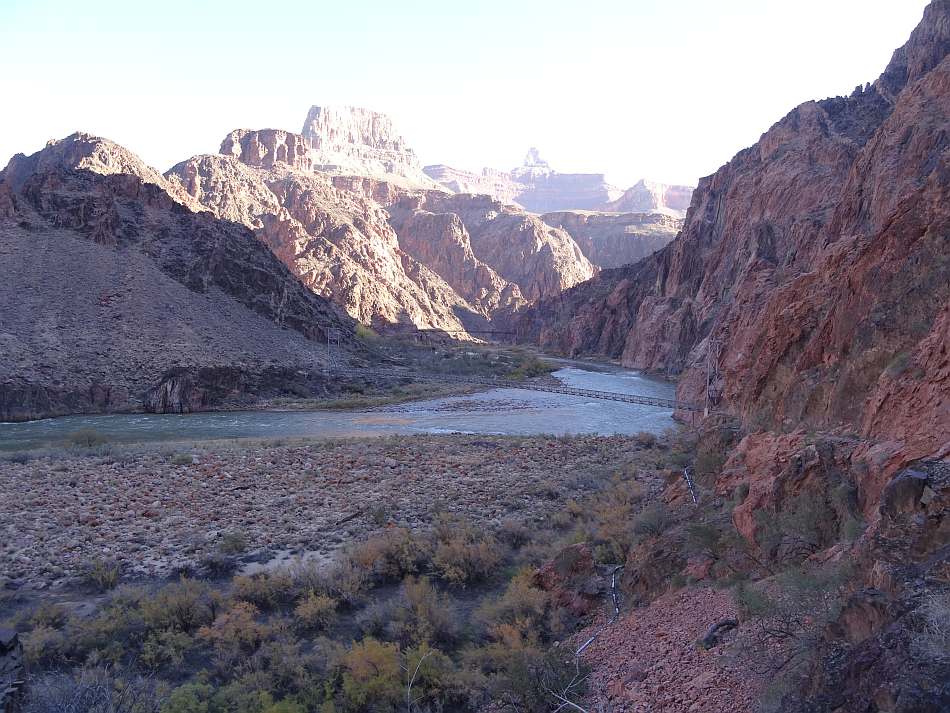
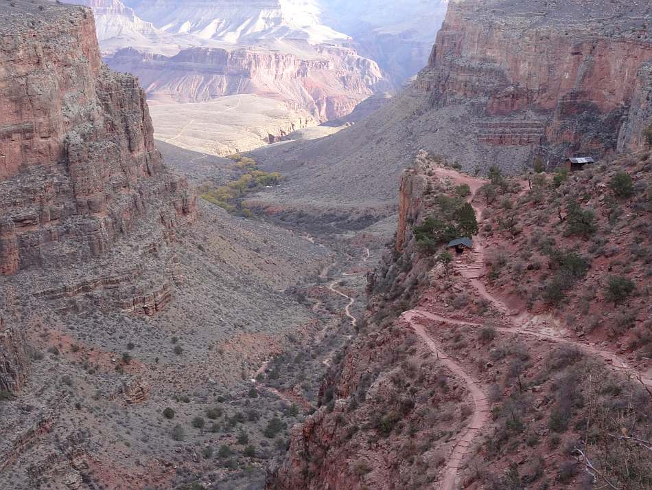
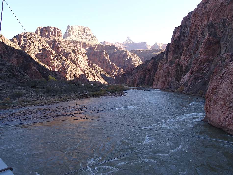
The next day was down to the river, across the Silver bridge to the River Trail. It is 1.3 miles to the Pipe Creek (aka River) Resthouse and junction with the Bright Angel Trail. The trail provides a sweeping view of the river and the two bridges, Silver and Black. At the resthouse there is a toilet building nearby but no water. There is a phone in the resthouse which is important to know because this is a typical destination for day hikers doing a Rim to River hike. It is 7.8 miles and a 4,400 foot descent from the South Rim and 7.8 miles and a 4,400 ascent back up. It is not unusual for a person to enjoy the benefits of gravity and arrive at the river exhausted and in need of help. Hence the phone. There is also a beach used by the Colorado River rafters.
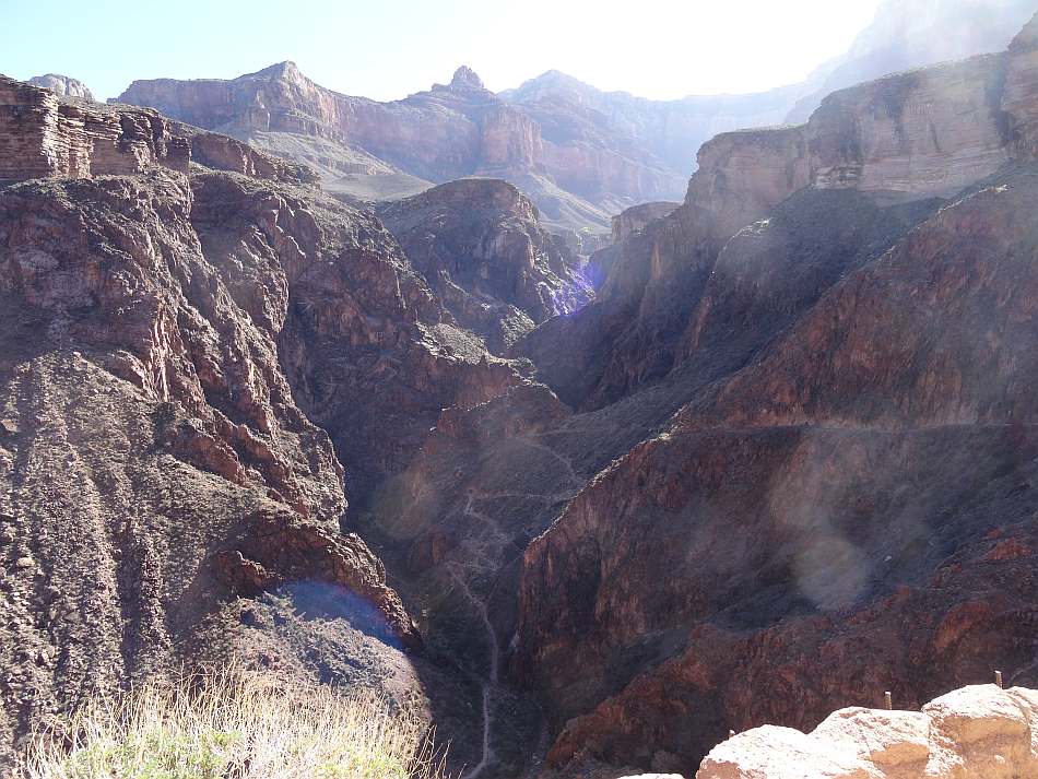
From the river it is 3.2 miles to Havasupai Garden. On the way the trail follows Garden Creek up a narrow canyon for about 0.4 miles. Then it changes to follow Pipe Creek because there is a cliff further up the Garden Creek drainage. A half mile further is the Devil's Corkscrew, a series of steep switchbacks up the Vishnu back to Garden Creek. A little further and the trail levels off and hits some areas where you have walk in the creek. With the pipeline project, they are building a better trail so this may no longer be wet crossings.
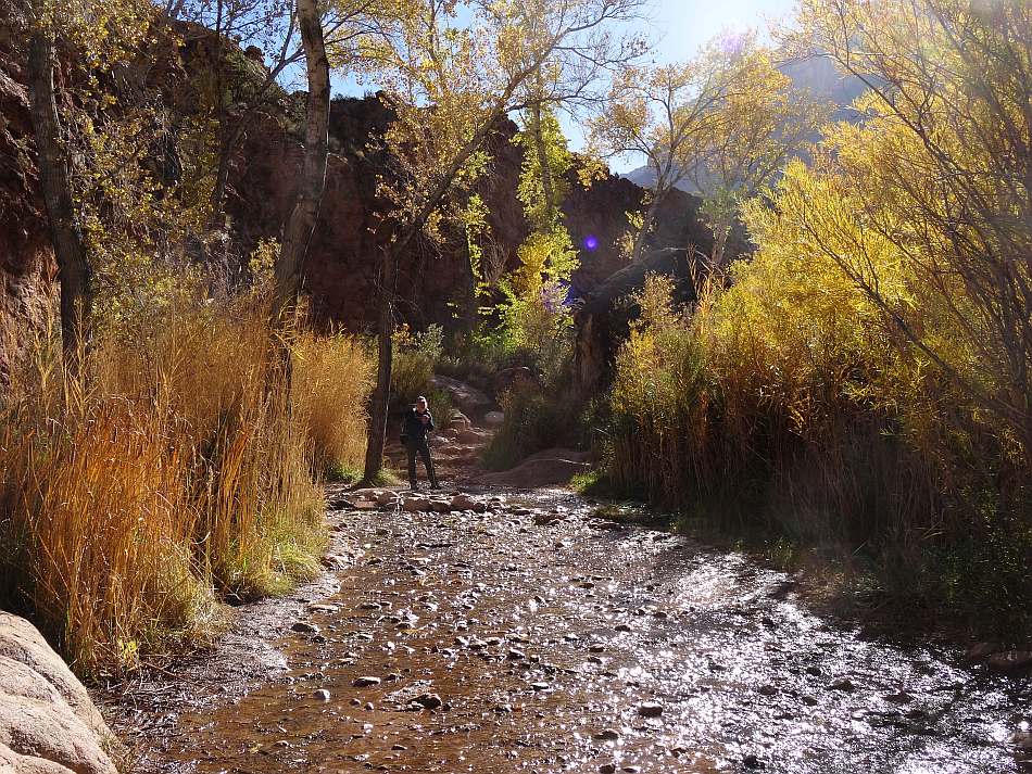
The Garden is covered with cottonwood trees providing respite from the desert sun. As with the other campgrounds, there are tent pads, picnic tables, hanging bars and food boxes. There are toilets and potable water from a tap. Also as with the other campgrounds, camping is by permit/reservation but specific tent sites are first-come. Since it was November 30, the sun was low, it was cold and by midafternoon we were in permanent shade. While still light, there was a bit of helicopter activity. Some were workers and supplies for the TCWL and one included an evac for one of the hikers that came in with us on the North Rim shuttle. That night it got down to 20 degrees so, yes, it can be cold there in the late fall.
We had a long drive to Albuquerque the next day so we got up in the dark, skipped breakfast and coffee and hit the trail. The 4.5 mile hike is up 3,000 feet. The first mile is a mild uphill covering 400 feet. Then you get to the colluvium from the Redwall and soon after the switchbacks up the Redwall. At the top of that section is the 3 mile resthouse with a toilet and possibly water (check ahead of time because it is shut off from October to May and the pipeline work could interrupt flow). The toilet in on a spur trail to the east.
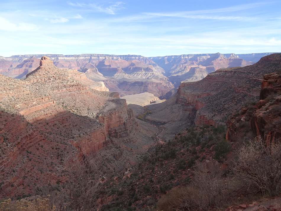
For the next mile it is up 680 feet of switchbacks over the Supai Group rock formation. As mostly shale, siltstone and fine-grained sandstone, there are no major cliffs. At 2 miles-from-the-top, the trail crosses Garden Creek. Garden Creek is what formed Garden Creek Canyon and it is there because it follows the fractured rocks of the Bright Angel Fault. In fact, this fault crosses the river and goes all the way to the North Rim directing the route of Bright Angel Creek.
After crossing the fault and the creek, the trail takes advantage of the sloping Supai to gain elevation. When it re-crosses the fault, it is now on top of the Esplanade Sandstone, a cliff former. This route across the fault eliminated the need for tight switchbacks up a cliff. One and a half miles from the top is the 1.5 mile resthouse. It is on the left of the trail after a switch back. The view is spectacular and you can see the cottonwood grove of Supai Garden in the distance. Water is available seasonally. If you need a toilet, go back to the switchback but go straight instead of going back downhill.
Over the next 0.2 miles, the Coconino Sandstone is the a white cliff above you. Then it hits the fault again and using a half a dozen tight switchbacks over the fault-scarp colluvium it brings you out on top of the Coconino cliff and the second tunnel (first this direction). It is about 0.8 miles across the Toroweap formation, back and forth across the fault to the Kaibab Limestone, to the first tunnel and a little over 0.1 to the Bright Angel Trailhead.
Other hikes
First Hike: Prior to the Rim to Rim hike, I had taken several trips along the Bright Angel-Kiabab corridor. The first was during spring break while in grad school. We hiked the Kaibab Trail from Yaqui Point to Phantom Ranch and spent a couple night there. Jay had told us it “never rains at the bottom of the Grand Canyon" so we went without tents. Luckily, there was a shelter that our whole group could fit in because whatever came out of the sky was wet. The next day we hiked to Ribbon Falls and spent another night in the shelter. Did I mentioned the skunk?
The next night was supposed to be in then-named Indian Garden. It was raining when we arrived, the ground was soaked and there wasn’t room or dry ground in the shelter so we decided to hike the 3,000 feet back up to the cars. As soon as we started up the Redwall, the rain turned to snow.
Long story short, one of the crew fell behind; dropped their pack, sleeping bag and supplies and after a few hundred yard, sat down and gave up. I was at the shelter when I heard this and went back down to help. Never leave your gear no matter how tired you are; it can save your life. We made it to the shelter and she wasn’t going any further so we spent the night. I went outside in the middle of the night and the snow had made the canyon walls around us white and with the light from the lodge above, it glowed. But looking down was even cooler. It was a pitch-black abyss. I still remember that night with awe all these years later.
Second Hike: The second hike was with the crew I hiked with for decades. It was late October and we started at Grand Canyon Village on the Bright Angel Trail and headed for then-Indian Garden. It was a 3000 foot descent over 4.5 miles. We passed through the Paleozoic sediment described in the geology section to the cottonwoods of the Garden. It was camping by reservation and permit. Toilets and potable water were available and we definitely had tents.
The next day we hiked the Tonto Trail to the east to connect with the Kaibab Trail. The trail on the Tonto Platform is through Sonora Desert type-ecology. Trail is picked up 0.3 miles north of the Plateau Point trail junction on the Bright Angel Trail. It is 4 miles across desert scrub to the Kaibab Trail. You are mostly on the Bright Angel Shale but near some of the small canyons you cross the Tapeats Sandstone. The maps shows you pass near Burro Spring and Pipe Spring. Burro Spring is considered unreliable and muddy. Pipe Spring is more reliable and cleaner but still needs filtering. Since it is only 2 miles from Supai Garden, I suggest you top-off before you leave.
From the Kaibab junction it is about 2 miles downhill through the Supergroup and Vishnu to the Black Bridge over the Colorado River. It is another 0.3 miles to the junction with the River Trail that crosses the Colorado on the Silver Bridge and leads to the Bright Angel Trail, and an additional 0.2 miles to the Bright Angel/Phantom Ranch campground.
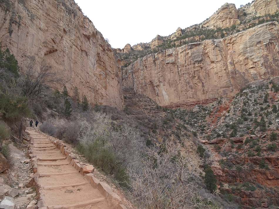
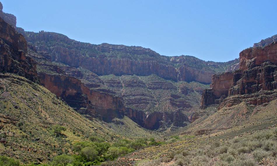
We stayed at the campground and hiked to Cottonwood Campground the next day for 2 nights. The trip is 7.0 miles up Bright Angel Creek on the North Kaibab Trail. Once out of the Phantom Ranch area, the trail enters the Box, a steep sided gorge. There is not a lot of room so the trail has to cross the creek on bridges several times, with the bridge named as the miles from the Kaibab-River Trail junction. As you cross the 1.3 mile and 1.5 mile bridges you are entering the Box. Phantom Creek comes in from the west at 1.6 miles. You stay in the Box past the 3.5 and 3.7 mile bridges. Soon after the Bright Angel Canyon walls open up and there is enough room so that the trail can stay on the east side of the creek to Cottonwood.
Ribbon Falls is at about mile 6 from Bright Angel Campground. There are a couple side trails to the falls but since it is across the Bright Angel Creek it requires wading. There has been a bridge at times but it was removed. The Grand Canyon Conservancy is trying to raise money to build a new one. While most only see the lower falls, Upper Ribbon Falls is the more spectacular and given its ribbon like cascade, probably the reason for its name. The Upper is about 0.8 miles from the North Kaibab Trail.
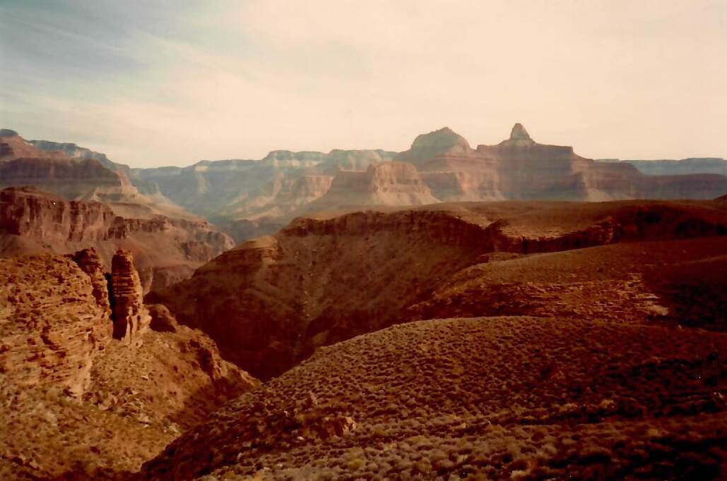
Another mile further is Cottonwood Campground. We spent 2 nights there and hiked part of the way up the trail to the North Rim on our free day. The following day we went back to Phantom Ranch/Bright Angel Campground for a night and then back to Indian Garden for the last night. We took the opportunity to haul our food and stoves to Plateau Point to make dinner and catch the view of the Great Unconformity.
The last day was the 3000 foot climb over 4.5 miles to the South Rim and Grand Canyon Village.
To Buy Maps: The entire trail is a two map set. Color, 11x17 maps on weatherproof paper are available for $5 each ($10 for the set) plus S&H by emailing Charlie at cew5151@gmail.com (copy and paste in your email).
----Photos by Robin Keasler----